
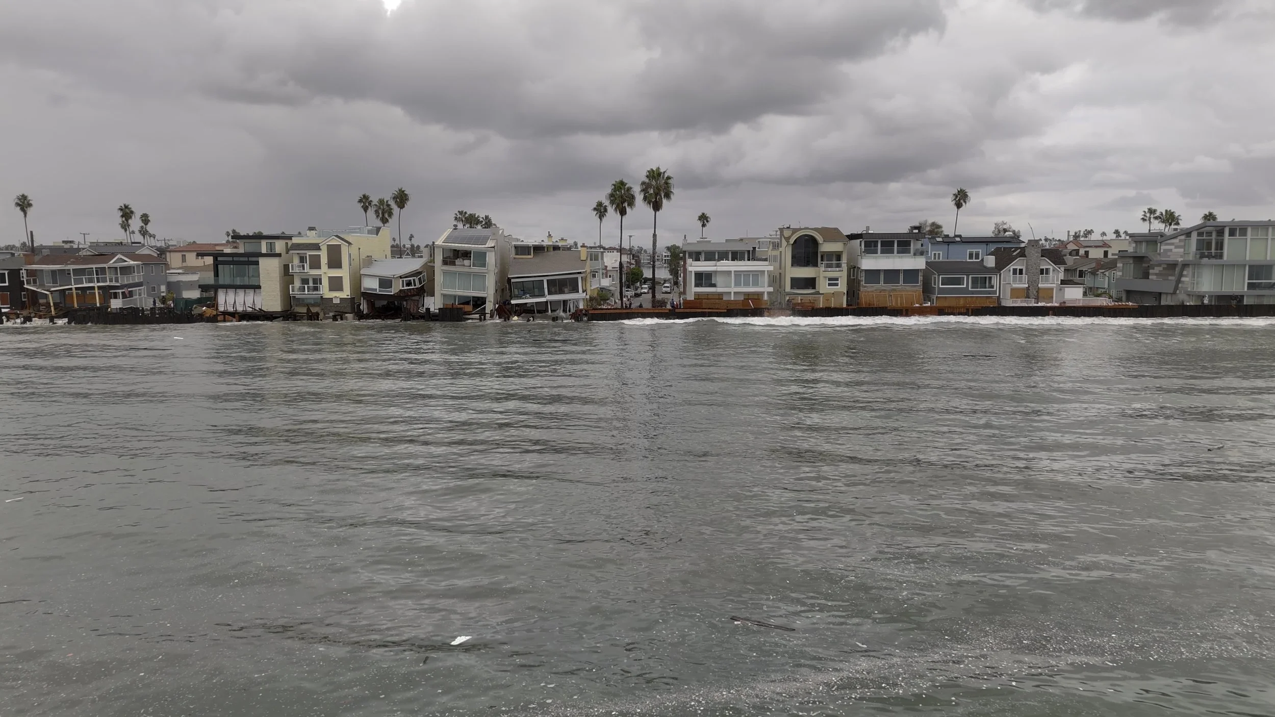
Long Beach Peninsula: Aerial Coastal Documentation
West Coast Drone Operations documented the Long Beach Peninsula on October 12, 2026. See how aerial imagery can support coastal condition records, repeat-view comparisons, and environmental project documentation.
Footage captured October 12, 2026 | West Coast Drone Operations
On October 12, 2026, West Coast Drone Operations captured aerial footage of the Long Beach Peninsula following recent high surf and coastal flooding.
The footage creates a dated visual record of the shoreline, providing context for understanding visible conditions and a reference for future documentation.
Capture Record
Long Beach Peninsula · October 12, 2026
Aerial footage by West Coast Drone Operations
A View of Coastal Conditions
Aerial imagery helps show the relationship between the shoreline, beachfront properties, and adjacent infrastructure. Ground-based photography can complement that overview with closer views of accessible details.
For agencies, environmental consultants, engineers, and property teams, these perspectives can support site discussions, documentation planning, and communication with stakeholders.
The footage records conditions visible during the capture window. Structural safety, the causes of damage, and appropriate protective measures require evaluation by the responsible professionals.
From One Visit to a Record of Change
A single visit documents a moment. Repeat visits can help teams follow how a site changes over time.
Coastal and environmental documentation programs can support:
Baseline conditions: Record a site before anticipated weather, construction, or restoration work.
Post-event documentation: Capture visible conditions after high surf, flooding, or other events when access and flight conditions allow.
Repeat-view comparisons: Return to agreed viewpoints to make visible changes easier to follow.
Project progress: Document shoreline protection, repair, and restoration activities.
Stakeholder communication: Provide clear imagery for project discussions, briefings, and public updates.
Dates, locations, viewpoints, and relevant conditions matter when comparing imagery. Tide level and camera perspective can affect how a shoreline appears. Measuring erosion or sand-volume change requires a capture and analysis workflow designed for that purpose.
How WCDO Supports Environmental Documentation
Based in Long Beach, West Coast Drone Operations provides aerial, remote, and ground-based imaging for coastal and environmental projects across Southern California.
We plan capture around what your team needs to see and how the imagery will be used. Depending on the agreed scope, deliverables can include:
High-resolution aerial photographs.
Aerial and ground-based video.
Annotated still images.
Organized site imagery.
Repeat-view comparisons.
Recurring visual documentation.
A one-time visit can establish current conditions. A recurring program can create a consistent visual history of a shoreline, restoration project, or infrastructure site.
Coastal + Environmental Documentation
Document Your Site.
Track What Changes.
Tell us where your site is located, what your team needs to see, and whether you need a single capture or recurring documentation.
Discuss Your Project