
Long Beach Peninsula: Aerial Coastal Documentation
West Coast Drone Operations documented the Long Beach Peninsula on October 12, 2026. See how aerial imagery can support coastal condition records, repeat-view comparisons, and environmental project documentation.
Footage captured October 12, 2026 | West Coast Drone Operations
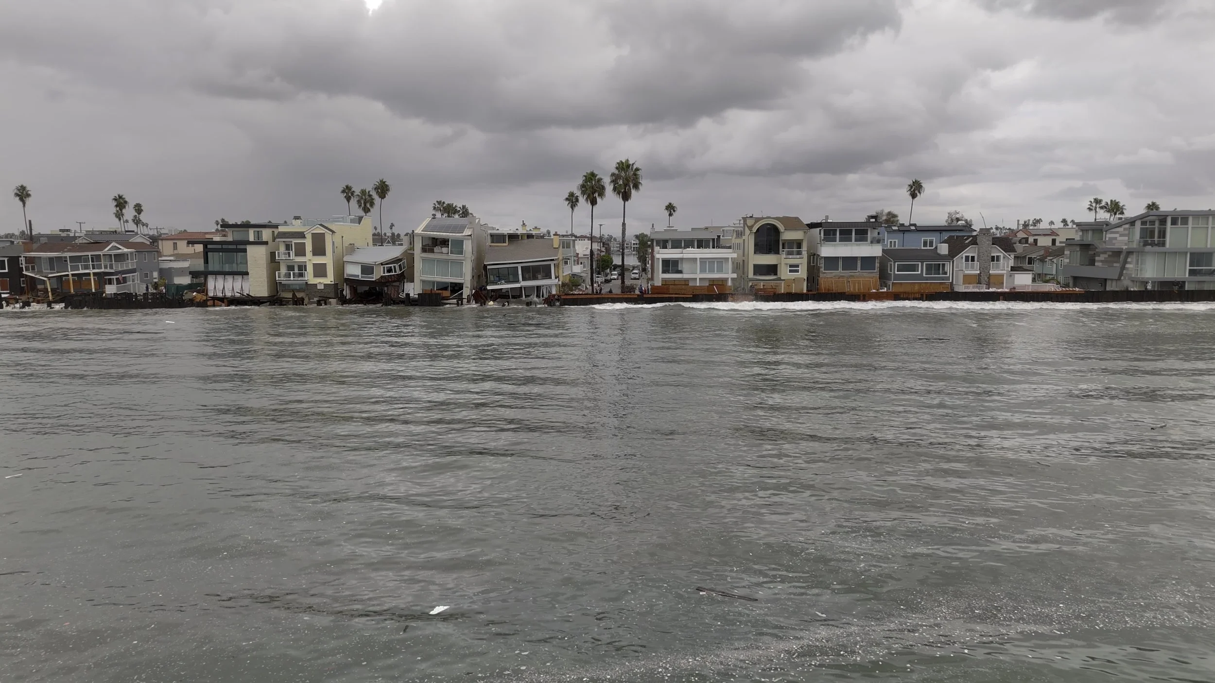
On October 12, 2026, West Coast Drone Operations captured aerial footage of the Long Beach Peninsula following recent high surf and coastal flooding.
The footage creates a dated visual record of the shoreline, providing context for understanding visible conditions and a reference for future documentation.
Capture Record
Long Beach Peninsula · October 12, 2026
Aerial footage by West Coast Drone Operations
A View of Coastal Conditions
Aerial imagery helps show the relationship between the shoreline, beachfront properties, and adjacent infrastructure. Ground-based photography can complement that overview with closer views of accessible details.
For agencies, environmental consultants, engineers, and property teams, these perspectives can support site discussions, documentation planning, and communication with stakeholders.
The footage records conditions visible during the capture window. Structural safety, the causes of damage, and appropriate protective measures require evaluation by the responsible professionals.
From One Visit to a Record of Change
A single visit documents a moment. Repeat visits can help teams follow how a site changes over time.
Coastal and environmental documentation programs can support:
Baseline conditions: Record a site before anticipated weather, construction, or restoration work.
Post-event documentation: Capture visible conditions after high surf, flooding, or other events when access and flight conditions allow.
Repeat-view comparisons: Return to agreed viewpoints to make visible changes easier to follow.
Project progress: Document shoreline protection, repair, and restoration activities.
Stakeholder communication: Provide clear imagery for project discussions, briefings, and public updates.
Dates, locations, viewpoints, and relevant conditions matter when comparing imagery. Tide level and camera perspective can affect how a shoreline appears. Measuring erosion or sand-volume change requires a capture and analysis workflow designed for that purpose.
How WCDO Supports Environmental Documentation
Based in Long Beach, West Coast Drone Operations provides aerial, remote, and ground-based imaging for coastal and environmental projects across Southern California.
We plan capture around what your team needs to see and how the imagery will be used. Depending on the agreed scope, deliverables can include:
High-resolution aerial photographs.
Aerial and ground-based video.
Annotated still images.
Organized site imagery.
Repeat-view comparisons.
Recurring visual documentation.
A one-time visit can establish current conditions. A recurring program can create a consistent visual history of a shoreline, restoration project, or infrastructure site.
Coastal + Environmental Documentation
Document Your Site.
Track What Changes.
Tell us where your site is located, what your team needs to see, and whether you need a single capture or recurring documentation.
Discuss Your Project
How Developers and Lenders Use Aerial Documentation for Draw Requests and Reporting
Every construction draw request depends on proving that the money already spent actually became physical progress. Here's how aerial documentation supports that process for developers, lenders, and inspectors alike.
Construction financing runs on a simple principle: money gets released in stages, and each stage depends on proving that the previous funds actually turned into physical progress.
That's the draw request process, and it depends heavily on documentation. Traditionally, that's meant site visits, written progress reports, and photographs taken by whoever happens to be available to capture them. Increasingly, developers and lenders are using consistent aerial documentation to make that process faster, clearer, and easier to verify.
RELATED: Construction Site Monitoring: A Practical Guide for Project Teams
Why Draw Requests Depend So Heavily on Documentation
A construction loan is typically disbursed in draws tied to completed milestones or a percentage of overall project completion. Before releasing each draw, a lender needs reasonable assurance that the work described in the request has actually been completed.
That verification usually falls to some combination of:
The borrower's own progress reporting
A third-party inspector or construction monitoring firm
Site visits by lender representatives
Photographic or visual documentation supporting the request
The stronger and more consistent the documentation, the more efficiently this process tends to move. Vague or inconsistent documentation, on the other hand, can slow down draws, prompt additional site visits, or create friction between the developer and lender at exactly the point in a project when cash flow matters most.
What Aerial Documentation Adds to the Draw Process
Consistent aerial imagery can support draw requests in a few specific ways:
Objective, dated visual evidence. Aerial imagery tied to a specific date provides a form of documentation that isn't dependent on the borrower's own account of progress. This can be useful for both developers building a strong case and lenders looking for independent verification.
Full-site context. Rather than a handful of photos from a site walk, aerial capture can show the entire project at once, making it easier to assess overall percentage of completion rather than relying on isolated close-up shots.
Comparability across draw periods. When imagery is captured from consistent viewpoints at each draw milestone, comparing progress between draw requests becomes straightforward. Reviewers can see change directly rather than relying on written descriptions.
Reduced need for in-person inspections. For lenders managing multiple projects or working with developers on out-of-area sites, consistent aerial documentation can reduce how often an in-person site visit is strictly necessary to verify progress, without eliminating site visits entirely.
Aligning Capture Schedules With Draw Milestones
For this use case, timing matters more than it might for general progress documentation. Rather than an arbitrary weekly or monthly schedule, the most useful approach is often to align aerial capture directly with the project's draw schedule.
That typically means:
Scheduling flights to occur shortly before each draw request is submitted
Capturing imagery that specifically documents the milestones tied to that draw
Maintaining consistent viewpoints so each draw's imagery can be directly compared to the previous one
Organizing and dating deliverables clearly enough to be included directly in the draw package
Some projects combine this with a broader recurring monitoring program. That can look like regular biweekly or monthly flights for general progress tracking, with additional or more detailed capture specifically timed around each draw submission.
What Lenders Should Look for in Draw-Related Documentation
For lenders and construction loan administrators evaluating documentation as part of a draw request, a few qualities tend to matter most:
Clear, verifiable dates on all imagery
Consistency with previous submissions, so comparisons are straightforward
Full-site coverage, not just close-ups of specific completed elements
Independent capture, for example, imagery from a third-party provider rather than solely from the borrower's own team can add a layer of objectivity to the record
None of this requires an elaborate program. In many cases, a well-organized set of consistent aerial photographs, captured on a schedule aligned with draws, is sufficient to meaningfully strengthen a draw package.
What This Looks Like for a Developer
For developers managing a construction loan, building aerial documentation into the draw process can help in a few practical ways:
Faster draw approvals, since strong, consistent documentation reduces back-and-forth or requests for additional verification
Fewer required site visits, which can save time for both the developer and lender representatives
A stronger record for future financing, since a well-documented project history can support refinancing, additional financing, or future lender relationships
Better internal reporting, since the same imagery used for draws can typically double as material for investor updates or internal project reviews
Setting This Up From the Start of a Project
As with other specialized documentation needs, the most effective approach is establishing this from the beginning of a project rather than trying to retrofit a monitoring program after draws are already underway.
Early in the process, it's worth clarifying:
The project's draw schedule and how capture timing should align with it
Whether the lender has specific documentation requirements or preferences
Who on the developer's team will be responsible for including imagery in draw packages
Whether a broader recurring monitoring program makes sense alongside draw-specific capture
Frequently Asked Questions
Do lenders require aerial documentation for construction draw requests? Requirements vary by lender and loan structure. Some lenders have specific documentation requirements, while others are simply looking for sufficient evidence of progress. Aerial imagery can strengthen a draw package in either case.
How often should aerial capture happen for draw request purposes? This is typically aligned with the project's draw schedule rather than a fixed calendar, so imagery is available shortly before each draw request is submitted.
Can aerial documentation replace in-person lender inspections? Not entirely, but it can reduce how frequently in-person inspections are necessary and can make the ones that do occur more efficient, since the reviewer arrives with existing visual context.
Aerial Documentation Built Around Your Draw Schedule
Strong documentation can make the draw request process faster and less contentious for everyone involved.
West Coast Drone Operations works with developers, lenders, and construction teams across Southern California to build aerial monitoring programs aligned with draw schedules and lender reporting requirements.
Need documentation that supports your project's financing process?
Discuss a Documentation Program →
What to Document on Education + Institutional Construction Projects
School and institutional projects come with reporting requirements, community stakeholders, and phasing constraints most commercial builds don't have. Here's what's worth documenting from the air on these projects specifically.
Education and institutional construction projects operate differently from most commercial builds. They often involve public funding and the reporting requirements that come with it. They frequently happen in occupied or partially occupied facilities. And they answer to a wider group of stakeholders (school boards, district administrators, bond oversight committees, and the surrounding community) than a typical private development.
That combination changes what's actually worth documenting from the air. A generic construction progress program built for a commercial office building doesn't automatically translate to a K-12 campus or higher-education project. Here's what tends to matter most on these sites specifically.
Bond and Public Funding Documentation
Many school and institutional projects are funded through public bonds, which often come with reporting obligations to demonstrate that funds are being used as intended and that construction is progressing on schedule.
Consistent, dated aerial imagery can directly support this kind of reporting by providing:
A clear visual record tied to specific funding milestones or reporting periods
Documentation that can be shared with bond oversight committees or district boards without requiring a site visit
An objective record that supports, rather than depends on, written progress reports
For districts and institutions managing public funds, this kind of documentation isn't just useful, it can be part of demonstrating accountability to the public that approved the funding in the first place.
Phased Construction Around Occupied Facilities
A significant number of school projects happen while all or part of a campus remains occupied, with students and staff continuing to use portions of the site while construction occurs elsewhere on the property.
Aerial monitoring is particularly useful in this context for documenting:
Construction boundaries and fencing, confirming separation between active work areas and occupied portions of campus
Phasing progress, especially when a project moves through the campus in stages rather than all at once
Site access changes, including how construction affects drop-off zones, parking, and pedestian routes during active phases
Timing around school calendars, particularly work planned around breaks, summer sessions, or other windows with reduced occupancy
This kind of documentation supports both safety and operational coordination, helping administrators understand exactly how construction activity relates to occupied areas at any given point.
Community and Stakeholder Communication
School projects tend to have a broader, more engaged group of stakeholders than most commercial construction. Parents, community members, school board members, and local media may all have interest in a project's progress, particularly for larger bond-funded builds.
Aerial imagery can support this kind of communication through:
Board meeting presentations showing overall project progress
Community updates or newsletters that give parents and neighbors visibility into construction
Groundbreaking and ribbon-cutting documentation for public milestones
Consistent imagery that can be used across multiple communication channels without requiring a new site visit each time
For districts and institutions, this is often one of the most immediately visible benefits of aerial monitoring, it gives administrators a straightforward way to keep a wider audience informed without pulling staff away from other responsibilities to produce updates.
Milestone Documentation Specific to Campus Projects
While many construction milestones are consistent across project types, school and institutional builds often have their own set of particularly important phases to document:
Site preparation and demolition, especially around existing occupied structures
Foundation and structural work for new buildings or additions
Modular or portable classroom installation, where applicable
Utility and infrastructure tie-ins to existing campus systems
Safety and security features specific to school facilities
Exterior and site work, including athletic facilities, play areas, and landscaping
Substantial completion ahead of occupancy or the start of a new school year
Because many school projects work against a hard deadline (the start of a new academic year) documenting progress against these milestones can help administrators and construction teams identify early whether a project is tracking toward that date.
Working Around School Schedules and Restrictions
Unlike most commercial sites, school and institutional properties often come with additional operational considerations for aerial flights:
Flight timing around school hours, particularly for sites with occupied portions of campus
Coordination with campus safety and administration, since flights may need to be scheduled around events, drills, or other campus activity
Privacy considerations, particularly around capturing imagery near occupied areas with students present
District-specific approval processes, which can differ from the more straightforward site-access process on a typical commercial project
A drone provider experienced with school and institutional work should be familiar with navigating these considerations as a standard part of the process, not something the district or construction team needs to manage independently.
Building a Monitoring Program for a School or Institutional Project
A well-structured program for this project type typically includes:
A capture schedule aligned with both construction milestones and any bond or funding reporting requirements
Flight timing coordinated around school hours, events, and campus activity
Deliverables organized for easy use in board presentations and community communications
Documentation of phasing and site boundaries, particularly for projects near occupied areas
A point of contact who understands how to coordinate with district administration and campus safety, not just the construction team
Frequently Asked Questions
How is documentation different for a bond-funded school project versus private construction? Bond-funded projects often have specific reporting obligations to oversight committees or the public, which can shape what's documented and how it's organized — consistent, dated imagery tied to funding milestones is particularly useful in this context.
Can drone flights happen while a school is in session? Often yes, with appropriate coordination around school hours, campus safety protocols, and any district-specific approval requirements. This should be planned with the school or district in advance of the first flight.
How often should a school construction project be documented? This depends on the project's pace, phasing, and reporting needs, many institutional projects benefit from biweekly or milestone-based monitoring, particularly when work is phased around an occupied campus.
Aerial Documentation for School and Institutional Projects
School and institutional construction comes with reporting requirements, stakeholder expectations, and operational considerations that a generic monitoring program isn't built to handle.
West Coast Drone Operations works with districts, institutions, and their construction teams across Southern California to build monitoring programs designed around campus schedules, bond reporting needs, and community communication.
Recurring aerial documentation can give project teams and stakeholders a consistent record of progress and site conditions throughout construction. Answer a few quick questions to explore what monitoring approach may make sense for your project.
Take the Aerial Opportunity Assessment →
FAA Rules and Airspace Considerations for Construction Drone Flights in Southern California
Southern California's dense airspace and busy construction market make regulatory compliance a bigger part of drone monitoring than many project teams expect. Here's what's involved.
Flying a drone over a construction site sounds simple. In practice, it involves navigating a regulatory framework that most project teams never have to think about … until they're the ones responsible for making sure a flight is legal.
This matters more in Southern California than in a lot of other regions. Much of the commercial construction activity across Los Angeles, Orange County, and the broader region sits within or near controlled airspace tied to major airports: LAX, John Wayne (SNA), Long Beach (LGB), Burbank (BUR), and others. That density means construction teams considering drone monitoring should understand, at a basic level, what's actually required before flights begin.
Commercial Drone Flights Require FAA Part 107 Certification
Any drone flight conducted for a business purpose, including construction progress monitoring, falls under the FAA's Part 107 rule for commercial small unmanned aircraft operations.
That means the pilot operating the drone must hold a current Part 107 remote pilot certificate, and the operation must comply with the rule's requirements around altitude limits, visual line of sight, operating over people, and other operational restrictions.
For project teams hiring a drone service provider, this is a straightforward but important check: confirm the operator is Part 107 certified and can speak clearly to how their operations comply with the rule, rather than simply assuming any drone operator is qualified to fly commercially.
Controlled Airspace Is Common Near SoCal Construction Sites
A significant portion of Southern California sits within Class B, C, or D controlled airspace, tied to the region's dense concentration of major and regional airports.
For a construction site located within controlled airspace, flying a drone typically requires either:
LAANC authorization (Low Altitude Authorization and Notification Capability), an automated system that can grant near-real-time approval for flights below a pre-approved altitude in most controlled airspace, or
A manual FAA airspace authorization, when LAANC authorization isn't available for the specific location or altitude needed
In practice, this means a construction site a few miles from LAX, SNA, LGB, or another regional airport may require airspace coordination before a flight can legally take place. This is something that should be planned for as part of scheduling a monitoring program, not discovered on the day of the first flight.
Site-Specific Operational Considerations
Beyond airspace classification, active construction sites introduce their own operational factors that a qualified drone operator needs to account for:
Cranes and tall equipment. Active tower cranes, telehandlers, and other tall equipment can create obstacles and, in some cases, additional airspace considerations depending on height and location.
Workers and site personnel. Operating over people carries specific restrictions under Part 107, which affects flight planning on an active site with crews present.
Site safety protocols. Many job sites have their own safety requirements for any aerial activity, which a drone operator should be prepared to coordinate around rather than treat as secondary to the flight itself.
Neighboring properties. Adjacent buildings, roadways, and properties can factor into flight planning, particularly for lower-altitude or close-proximity capture.
Time-of-day restrictions. Some flights (for example, nighttime capture for certain inspection use cases) require additional certification and authorization beyond standard daytime operations.
None of this should fall on the construction team to manage. A professional drone operator experienced with active job sites should handle airspace coordination, safety planning, and regulatory compliance as a standard part of the service, not as something the project team needs to research themselves.
What This Means for Scheduling a Monitoring Program
For a recurring construction monitoring program, regulatory considerations are generally a planning issue rather than an ongoing obstacle. Once a site's airspace classification and any recurring authorization needs are established, subsequent flights can typically follow a predictable, repeatable process.
That said, it's worth building a small amount of buffer into scheduling expectations, particularly for:
The first flight at a new site, while airspace authorization is being established
Sites in more complex or restricted airspace, where manual authorization may take longer than an automated LAANC approval
Projects near helipads, temporary flight restrictions, or other less predictable airspace factors
A drone operator familiar with the region should be able to explain these factors upfront and build them into the monitoring schedule, rather than treating them as surprises.
Questions to Ask a Drone Provider About Compliance
Before starting a recurring monitoring program, it's reasonable to ask a provider directly:
Are your pilots FAA Part 107 certified?
Is our site located in controlled airspace, and if so, what authorization is required?
How do you handle sites near cranes, tall equipment, or other obstacles?
What's your process for flying over active work areas with personnel present?
How do you account for airspace or authorization requirements when scheduling recurring flights?
A provider with real experience on active construction sites should be able to answer these clearly and specifically, not in vague reassurances.
Frequently Asked Questions
Does every construction site in Southern California require special drone authorization? Not every site, but a substantial portion do, given how much of the region sits within controlled airspace tied to major and regional airports. It depends on the specific location relative to nearby airspace boundaries.
How long does airspace authorization typically take? LAANC authorization can often be granted in near-real time for pre-approved altitudes. Manual FAA authorization, when required, can take longer and should be factored into project timelines in advance.
Can a construction team fly its own drone for progress photos instead of hiring a provider? Any commercial use of a drone, including construction progress documentation, requires a Part 107-certified pilot and compliance with applicable airspace and operational rules, regardless of who is flying it.
Compliant Drone Monitoring for Active Construction Sites
Navigating airspace and regulatory requirements shouldn't be something a construction team has to figure out on their own.
West Coast Drone Operations operates with FAA Part 107-certified pilots across Southern California, handling airspace authorization, site safety coordination, and regulatory compliance as a standard part of every construction monitoring program.
Airspace, nearby airports, active crews, cranes, and site conditions can all affect how a construction drone program is planned. Answer a few quick questions about your project to explore where aerial monitoring may fit.
Take the Aerial Opportunity Assessment →
Using Drone Documentation for Change Orders and Construction Claims
When a change order or dispute comes down to "what did the site actually look like on that date," consistent aerial documentation can be the difference between a strong case and a guess. Here's how construction teams put it to work.
Most construction teams set up aerial monitoring to track progress. Fewer think about it as something they might need to lean on months later when a change order is being disputed, a delay claim is filed, or a disagreement surfaces about what conditions actually existed on a given date.
That's often exactly when consistent documentation becomes most valuable.
Written logs and meeting notes can be incomplete or contested. Memory is unreliable. But dated, consistent aerial imagery showing exactly what a site looked like at a specific point in time is difficult to argue with. This is why more project teams are treating drone documentation as part of their risk-management strategy, not just their marketing or reporting toolkit.
Why Documentation Matters More Than It Seems Until It's Needed
Change orders, delay claims, and disputes rarely announce themselves in advance.
A trade may claim they couldn't access an area on a certain date. An owner may question whether a condition existed before or after a specific milestone. A subcontractor may dispute when a site was actually ready for their scope of work.
In each of these situations, the question comes down to the same thing:
What did the site actually look like, and when?
Written records can help answer that question. But a dated photograph or video, especially one captured as part of a consistent, recurring program, provides something written documentation often can't: an objective, visual record that isn't dependent on anyone's recollection or interpretation.
Where Aerial Documentation Tends to Matter Most
Not every dispute or change order benefits equally from aerial evidence. It tends to be most useful in situations involving:
Site access and readiness disputes. Was an area actually clear, graded, or otherwise ready for a specific trade to begin work on the date in question?
Delay claims. Did work stop, slow down, or fail to progress during a period a party claims it should have?
Weather and condition-related disputes. What were actual site conditions (standing water, unstable ground, incomplete grading, etc.) around a specific weather event or claimed delay?
Scope and condition verification. Did a condition exist before a certain date, or did it appear afterward? Was work completed to the extent claimed by a specific milestone?
Damage or defect timing. When did a specific condition first become visible, and what did the surrounding area look like at that time?
In each case, the value isn't a single photograph. It's having a consistent record over time that can show what changed, when, and in what sequence.
Why Consistency Matters More Here Than Almost Anywhere Else
For general progress documentation, some inconsistency in viewpoints or timing is a minor inconvenience. For documentation that might support a claim or dispute later, it can matter significantly more.
A useful documentation program for this purpose typically includes:
Repeatable viewpoints, so comparisons between dates are straightforward rather than requiring interpretation
Reliable, documented capture dates, since the timing of the imagery often matters as much as the content
Full-site coverage, not just areas that seemed important at the time — conditions that become relevant later aren't always predictable in advance
Organized, retrievable files, since documentation that can't be located or clearly dated months later loses much of its value
This is one of the strongest arguments for establishing a recurring monitoring program early in a project rather than waiting until a dispute has already emerged. By the time a disagreement surfaces, it's too late to go back and document what a site looked like weeks or months earlier.
What Aerial Documentation Can (and Can't) Do in a Dispute
It's worth being direct about the limits here.
Aerial imagery can provide a strong, objective visual record of site conditions at a point in time. It's not, on its own, a legal determination of fault, cause, or entitlement. Those conclusions typically require review by attorneys, claims consultants, or other qualified professionals who can evaluate the documentation alongside contracts, schedules, and other project records.
Think of consistent aerial documentation as evidence that supports a broader case, not as a self-contained argument. The strongest use of it is providing the objective visual record that other parts of the dispute process (legal review, expert analysis, negotiation) can then build on.
Setting Up a Program With This in Mind
If protecting against future disputes is part of why you're considering aerial monitoring, it's worth mentioning that upfront when setting up the program, rather than treating it purely as a progress-reporting tool. That framing can shape a few practical decisions:
Whether full-site coverage matters more than a narrower set of "interesting" viewpoints
How imagery should be organized and dated for easy retrieval later
Whether documentation should be captured at a frequency that aligns with the project's risk profile. High-change-order projects may warrant more frequent capture than a straightforward build
Whether deliverables need to be structured in a way that's easy to hand off to legal counsel or a claims consultant if needed
None of this requires an entirely separate monitoring program. In most cases, a well-structured recurring documentation schedule (the same one supporting general progress reporting) can serve this purpose too, as long as consistency and full coverage are built in from the start.
Frequently Asked Questions
Can drone footage be used as evidence in a construction dispute? Consistent, dated aerial documentation can serve as objective visual evidence supporting a claim or dispute, though its legal weight and admissibility depend on the specifics of the situation — this is a question to direct to legal counsel familiar with the project and jurisdiction.
How far in advance should we set up documentation if we're worried about a future dispute? As early as possible. Documentation is most valuable when it exists consistently from the start of a project, since it's not possible to retroactively capture what a site looked like at an earlier date.
Does this require a different type of drone monitoring than standard progress documentation? Not necessarily a different program, but it may call for broader site coverage, stricter consistency in viewpoints, and more careful file organization than a purely reporting-focused program.
Build a Documentation Program That Protects the Project
Consistent aerial monitoring doesn't just track progress — it creates a visual record project teams can rely on if questions ever come up later.
West Coast Drone Operations provides recurring construction documentation across Southern California, structured to support both everyday progress reporting and the kind of consistent, well-organized record that holds up if a change order or dispute arises.
Consistent aerial documentation can give project teams a dated visual record of progress and site conditions throughout construction. Answer a few quick questions about your project to explore what monitoring approach may make sense.
Take the Aerial Opportunity Assessment →
Construction Progress Monitoring for GCs, Owners, and Lenders: Who Needs What
GCs, owners, and lenders don't use construction progress imagery the same way. Here's what each stakeholder actually needs from a drone monitoring program.
A drone flight over a job site produces one set of imagery. But the people who look at that imagery afterward rarely want the same thing from it.
A superintendent wants to see whether a specific area is ready for the next trade. An owner wants a sense of overall momentum. A lender wants proof that the money they released actually turned into physical progress.
Treating construction progress monitoring as one generic deliverable can leave some of those stakeholders underserved, even when the flight itself was well executed. The more useful approach is to understand what each group actually needs, then build a capture and delivery plan around those needs from the start.
General Contractors: Operational Detail
For a GC or superintendent, aerial imagery is a working tool, not a report.
What matters most to this audience:
Trade sequencing visibility: Seeing whether an area is actually ready for the next crew, not just "progress" in the abstract
Site logistics: Material staging, equipment positioning, access routes, and how those are shifting week to week
Conditions before they're covered: Rough-in work, structural elements, or grading that will be inaccessible once the next phase starts
Fast turnaround: Imagery that's useful within days, not weeks, since site conditions change quickly
GCs are less interested in polished, presentation-ready visuals and more interested in imagery they can act on immediately, cross-referencing it against the schedule, using it in a Monday morning coordination meeting, or settling a disagreement about what was or wasn't accessible on a given date.
Owners and Developers: Overall Momentum and Communication
Owners and developers are usually managing the project from a greater distance — sometimes literally, sometimes just organizationally. They're less focused on individual trade sequencing and more focused on the bigger picture.
What matters most to this audience:
A clear sense of pace: Is the project tracking with the schedule, ahead, or falling behind visually
Presentation-ready imagery: Material that can go directly into an investor update, board meeting, or stakeholder communication without additional editing
Consistency across the project timeline: The same viewpoints revisited so progress is easy to compare at a glance
Confidence between site visits: Enough visibility that they don't need to be on-site as often to stay informed
For this audience, the value isn't just documentation, it's communication. Aerial imagery becomes the visual language an owner uses to talk about the project with people who aren't as close to it.
Lenders and Financial Stakeholders: Verifiable Proof
Lenders occupy a different role entirely. They're not managing construction, they're evaluating whether disbursed funds correspond to actual physical progress.
What matters most to this audience:
Dated, verifiable imagery: A clear, defensible record of site conditions at a specific point in time
Consistency with draw schedules: Captures that align with funding milestones rather than an arbitrary calendar
Objective documentation: Imagery that stands on its own without requiring interpretation from the borrower
A defensible paper trail: A visual record that can be referenced if progress or timing is ever questioned later
Lenders generally aren't looking for cinematic footage. They're looking for something closer to evidence: consistent, dated, and difficult to dispute.
The Same Flight Can Serve All Three … If It's Planned That Way
None of this means a project needs three separate drone programs. In most cases, a single well-planned monitoring schedule can serve a GC, an owner, and a lender simultaneously but only if the capture plan accounts for all three from the outset.
That typically means:
Establishing repeatable viewpoints that work for both operational review and presentation use
Aligning capture dates with milestones or draw schedules where relevant, not just a generic calendar
Delivering imagery in a format and turnaround time that meets the fastest-moving stakeholder's needs
Keeping documentation organized and dated clearly enough to serve as a verifiable record if needed later
The mistake to avoid is designing a monitoring program around only one audience's needs and assuming it will automatically work for the others. A capture plan built exclusively for cinematic owner updates may not turn around fast enough for a superintendent. A plan built purely for operational speed may not be polished enough for a board presentation.
Questions to Ask Before Setting Up a Monitoring Program
If your project has multiple stakeholder groups relying on the same imagery, it's worth clarifying upfront:
Who will actually be reviewing this imagery, and how often?
Does the capture schedule need to align with draw requests or funding milestones?
How quickly does the GC need access to usable imagery after a flight?
Does the owner need presentation-ready material, or is raw documentation sufficient?
Will this imagery ever need to serve as a verifiable record (for a lender, an insurer, or a dispute)?
Answering these questions before the first flight makes it much easier to build one program that genuinely works for everyone relying on it, rather than retrofitting the plan later.
Frequently Asked Questions
Can one drone monitoring program really serve a GC, an owner, and a lender at the same time? Yes, in most cases— as long as the capture plan is designed with all three audiences in mind from the start, including turnaround time, viewpoint consistency, and alignment with any funding milestones.
Do lenders require a specific type of documentation from construction drone monitoring? Requirements vary by lender and project. In general, dated, consistent, and objectively presented imagery tends to serve this audience best. Some lenders may also have specific documentation requirements tied to draw schedules.
How is imagery for owners different from imagery for the construction team? Owners typically want polished, easy-to-understand imagery that communicates overall progress, while the construction team often needs faster, more operationally detailed imagery they can act on immediately.
Answer a few quick questions about your project, stakeholders, and documentation needs. Our Aerial Opportunity Assessment can help identify where recurring aerial monitoring may provide the most value.
Take the Aerial Opportunity Assessment →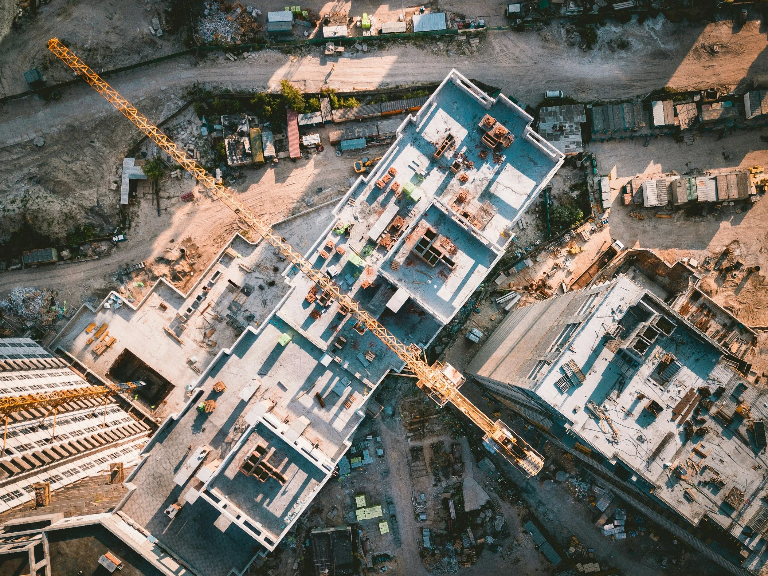
Construction Progress Monitoring: What Should You Actually Document?
Construction progress documentation is most useful when it's consistent. Here's what project teams should capture and how recurring aerial imagery can create a clearer visual record from milestone to milestone.
Construction progress photos are easy to take. Building a useful visual record of a project is harder.
A few aerial photos taken periodically may look impressive, but if the flight path, viewpoints, and areas documented change every time, comparing one visit to the next becomes difficult.
Effective construction progress monitoring is less about capturing more imagery and more about capturing the right imagery consistently.
For project managers, owners, developers, and other stakeholders, that consistency creates a visual timeline that makes it easier to understand what has changed, communicate progress, and revisit earlier site conditions when questions arise.
Here are the most useful elements to include in a recurring construction documentation program.
1. Consistent Overall Site Views
Start with the big picture. Wide aerial views can document the overall condition of the site and provide context that is difficult to capture from ground level.
The key is consistency. When possible, recurring flights should capture similar perspectives, elevations, and framing from one visit to the next. Over time, those images become a visual timeline of the project rather than a collection of unrelated photographs.
2. Major Construction Milestones
Not every stage of a project has equal documentation value. Depending on the project, important milestones might include:
Site preparation and grading
Foundation work
Structural progress
Roofing and building-envelope work
Exterior improvements
Utility or infrastructure installation
Paving and landscaping
Substantial completion
Documenting key phases gives teams reference points throughout the project's lifecycle.
3. Areas That Will Eventually Be Covered or Inaccessible
Some site conditions are temporary. Excavations are filled. Utilities are covered. Structural elements become enclosed. Equipment disappears. Access changes as construction advances.
Capturing these areas while they're visible creates a useful historical record of conditions that may be difficult, or impossible, to photograph later. Aerial imagery can be especially useful when those conditions span a large portion of a site.
4. Site Logistics and Access
Construction progress isn't limited to the building itself. Recurring aerial documentation can also provide context around:
Material staging
Equipment locations
Temporary access routes
Laydown areas
Site circulation
Perimeter conditions
Adjacent properties or infrastructure
These wider views help stakeholders understand how the entire site is evolving, not just the structure.
5. Specific Areas of Interest
Every project has areas that deserve additional attention. Project teams may want recurring imagery of a particular elevation, roof area, access point, drainage feature, utility corridor, or other location.
Identifying those priorities before a flight allows the aerial documentation plan to reflect the actual needs of the project rather than relying on generic coverage.
6. The Same Viewpoints Over Time
This is one of the simplest ways to make construction imagery substantially more useful.
Imagine seeing the same section of a project at:
Month 1 → Month 2 → Month 3 → Month 6 → Completion
The value isn't any single photograph — it's the comparison. Repeated viewpoints make change immediately visible and can create compelling before-and-after sequences for internal reporting, stakeholder communication, and final project documentation.
7. Ground-Level Context
Not everything should be documented from the air. Some details are better captured from the ground, which is why a useful visual documentation program may combine aerial imagery with ground-based photography or video.
Together, the two perspectives provide both site-wide context and closer views of relevant conditions.
8. Date and Location Information
Good construction documentation should be easy to understand later. At minimum, imagery should be organized so teams can determine when it was captured and what area of the project it represents.
Depending on the project's needs, deliverables may also include geo-referenced imagery or other structured visual documentation that makes files easier to organize and reference.
9. Changes Since the Previous Visit
Recurring monitoring becomes much more valuable when each capture builds on the last. Rather than treating every flight as an isolated event, teams can use sequential imagery to understand how site conditions have changed between visits.
That can be particularly useful for stakeholders who aren't able to visit the project regularly.
10. Final Conditions
Don't stop documenting just because construction is nearly complete. Final aerial and ground imagery establishes a visual record of the completed project and provides a natural endpoint to the progress timeline.
It can also become valuable material for owner documentation, stakeholder presentations, marketing, portfolio development, and future project communications.
How Often Should Construction Progress Be Documented?
There isn't one schedule that's right for every project. Some teams may benefit from weekly or biweekly documentation, while others may only need imagery at specific milestones or monthly intervals.
The better question is: how quickly is the site changing, and who needs visibility into that change?
A fast-moving project with multiple stakeholders may justify more frequent documentation. A slower project may benefit from milestone-based flights instead.
We cover this in more detail in our guide on how often to fly a drone for construction progress monitoring but the short version is that the objective should be to establish a cadence that captures meaningful change without collecting imagery simply for the sake of collecting it.
Frequently Asked Questions
What's the difference between construction progress photos and construction progress monitoring? Progress photos are individual snapshots. Monitoring is a recurring, consistent program (same viewpoints, regular intervals) that turns those snapshots into a comparable visual timeline.
Should construction documentation include ground photos or only aerial? Both, ideally. Aerial imagery captures site-wide context that's hard to get from the ground, while ground-level photos capture close-up details aerial views can miss.
Who typically uses construction progress documentation? Project managers, superintendents, owners, developers, lenders, and consultants commonly use it for progress reporting, stakeholder updates, and dispute or claims documentation.
Do we need geo-referenced imagery for our project? It depends on the project's needs. Geo-referenced deliverables are useful when imagery needs to be tied to precise site coordinates for engineering, surveying, or GIS purposes — not every project requires it.
Build a Repeatable Visual Record
The real advantage of recurring construction monitoring isn't simply having aerial photographs. It's having a consistent visual record of how a project changed over time.
Establishing repeatable viewpoints, documenting important milestones, and identifying priority areas before each visit can turn ordinary project photography into a much more useful resource for project teams.
Answer a few quick questions about your project, priorities, and documentation needs. Our Aerial Opportunity Assessment can help you identify where recurring aerial monitoring may add value.
Take the Aerial Opportunity Assessment →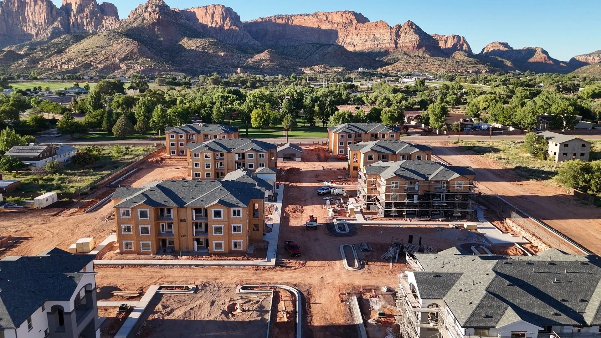
How Often Should You Fly a Drone for Construction Progress Monitoring?
Weekly, biweekly, monthly, or milestone-based? Learn how to choose the right drone construction monitoring schedule for your project in Southern California.
If you're considering drone construction progress monitoring for a project, one of the first questions is usually straightforward:
How often should we fly the site?
Weekly? Every two weeks? Once a month? Only when something important happens?
There isn't one schedule that's right for every project. The best construction progress monitoring cadence depends on how quickly the site is changing, what your team needs to document, who needs access to the imagery, and how the visual record will ultimately be used.
For some projects, a monthly flight provides plenty of visibility. For others, waiting four weeks between captures could mean missing significant phases of construction.
Here's how to determine what makes sense for your project, and where drone construction monitoring fits into your existing reporting workflow.
Why Monitoring Frequency Matters
A single drone flight provides a snapshot. Recurring flights create a record. That distinction is the whole reason a monitoring program outperforms one-off aerial photos.
When aerial imagery is captured consistently throughout construction, project teams can compare conditions over time rather than relying on isolated photographs. A monitoring program might document a site:
Week 1 → Week 2 → Week 3 → Week 4
or:
Existing conditions → excavation → foundation → structure → enclosure → completion
Over time, those individual captures become a visual timeline of the project.
But more isn't automatically better. Flying every week when meaningful site conditions only change monthly can create unnecessary imagery and expense. On the other hand, capturing a fast-moving project once a month can leave substantial gaps in the visual record.
The goal is to find a cadence that matches the pace and purpose of the project.
Weekly Construction Progress Monitoring
Weekly aerial monitoring provides the most detailed recurring record of the common monitoring schedules. It can make sense for active projects where substantial changes happen from one week to the next.
Weekly monitoring may be particularly useful when:
Construction is moving quickly
Multiple trades are active
Site logistics change frequently
Owners or other stakeholders want frequent visibility
The project team produces regular progress reports
Conditions may soon be covered or altered
The project has significant activity across a large site
When similar aerial viewpoints are captured each week, teams can quickly compare current conditions with previous ones. Instead of receiving a collection of unrelated drone photographs, the team develops a chronological record showing how the project evolved.
The tradeoff: Weekly monitoring produces more data and generally costs more over the life of the project. For projects with relatively slow visible progress, that level of frequency may not provide enough additional value to justify weekly flights. In those cases, biweekly monitoring can be a strong alternative.
Biweekly Construction Progress Monitoring
For many construction projects, every two weeks offers an effective balance between visibility and cost. Two weeks is often enough time for meaningful visual changes to occur while still providing a relatively detailed record of construction.
Biweekly monitoring can work well for:
Commercial construction
Multifamily development
School and institutional projects
Industrial projects
Larger site-development projects
Projects where stakeholders want regular updates without weekly reporting
It also provides a predictable rhythm: every other week, the site is captured from established viewpoints, the imagery is organized, and stakeholders receive an updated visual record.
For project teams considering recurring aerial monitoring for the first time, biweekly capture is a useful starting point. The schedule can always be adjusted as the project progresses.
Monthly Construction Progress Monitoring
Monthly monitoring provides a higher-level view of construction progress. Instead of documenting smaller week-to-week changes, monthly captures show larger shifts in the project.
This cadence may be appropriate when:
Construction is progressing relatively slowly
The project has a long duration
Leadership primarily needs high-level visibility
Imagery is being used for monthly reporting
Budget favors fewer site visits
The primary objective is creating a broad historical record
Monthly monitoring can also work well when aerial imagery supplements more frequent documentation already being collected by the onsite team.
There is, however, an important limitation: a lot can happen on an active construction site in 30 days. If documenting specific phases or temporary conditions is important, monthly monitoring may need to be supplemented with milestone flights.
Milestone-Based Drone Monitoring
Not every project needs a fixed recurring schedule. Some construction teams benefit more from capturing specific phases of work.
A milestone-based program might include flights around:
Pre-construction or existing conditions
Site clearing and preparation
Excavation
Foundation work
Structural progress
Building enclosure
Major infrastructure installation
Paving and landscaping
Substantial completion
Final project documentation
This approach can be particularly useful when the objective is to preserve a visual record of major project phases rather than track incremental progress. Milestone monitoring also works well as an addition to recurring flights. For example, a project could be captured monthly under normal conditions while additional flights are scheduled around important construction events.
A Hybrid Monitoring Schedule
In practice, the best monitoring schedule doesn't always fit neatly into weekly, biweekly, or monthly categories. Construction activity changes throughout a project — there may be periods when relatively little visible change occurs, followed by phases when the site transforms quickly. A flexible monitoring program can respond to that.
For example:
Pre-construction: Baseline capture
Site work and foundation: Biweekly
Rapid structural construction: Weekly
Slower interior phases: Monthly
Major exterior milestones: Additional targeted captures
Completion: Final comprehensive documentation
This approach concentrates monitoring where it provides the greatest value. (This is often the schedule we recommend by default).
Five Questions to Determine Your Monitoring Frequency
Before choosing a schedule, consider these questions.
1. How quickly is the site changing? If substantial changes occur every week, monthly imagery may leave major gaps. If visible progress happens more gradually, weekly flights may be unnecessary.
2. Who needs to see the imagery? Consider everyone who may use the documentation — project managers, superintendents, developers, owners, executives, consultants, marketing teams, or other stakeholders. A project with remote ownership or multiple decision-makers may benefit from more frequent visual updates.
3. What decisions will the imagery support? If aerial imagery is primarily creating a historical archive, less frequent monitoring may be sufficient. If the team plans to use imagery during regular project meetings or progress reporting, the capture schedule should align with those workflows.
4. Are important conditions temporary? Some site conditions don't remain visible for long — work gets covered, materials move, access routes change, excavations are filled, landscaping changes the site. If preserving those conditions matters, monitoring should occur frequently enough to capture them.
5. How long is the project? A six-month project and a three-year project may require very different approaches. The monitoring plan should consider both the frequency of individual flights and the value of the complete visual record being created over the project's lifespan.
Should You Use the Same Drone Viewpoints Every Time?
Whenever practical, yes. Repeatable viewpoints make construction progress easier to understand.
Imagine comparing two photographs taken six months apart. If one image faces north from 150 feet and another faces southwest from a completely different location, determining what changed requires more effort. Capture those images from similar perspectives, however, and the progression becomes much clearer.
A recurring monitoring program can establish a set of useful project views early and revisit them throughout construction. Additional imagery can still be captured when conditions warrant it. The repeatable views simply create the backbone of the project's visual record.
Can Drone Monitoring Reduce Site Visits?
For some stakeholders, it can reduce the need for certain informational visits; but it shouldn't be positioned as a universal replacement for being onsite. There are many reasons project personnel need to physically visit a construction site, and drone monitoring serves a different purpose.
It can give owners, executives, consultants, and remote team members additional visibility between visits and help them understand current site conditions before they arrive. For organizations managing multiple projects, that becomes especially valuable. Instead of relying entirely on written updates or isolated photographs, stakeholders can periodically see the broader context of each project.
What Should Be Captured During Each Visit?
Consistency is just as important as frequency. A construction monitoring visit may include:
Repeatable oblique views
Overhead imagery
Overall site conditions
Areas of active construction
Access and staging areas
Project-specific points of interest
High-resolution still photography
Aerial video when useful
Geo-referenced deliverables when required
The exact capture plan should reflect the project's needs. More imagery isn't necessarily more valuable — the objective should be to collect the right imagery consistently enough that it becomes useful over time.
Weekly vs. Biweekly vs. Monthly: A Simple Starting Point
If you're unsure where to begin, this framework can help.
Choose weekly monitoring when: the project is moving quickly and frequent visibility is important.
Choose biweekly monitoring when: you want consistent progress documentation while balancing frequency and cost.
Choose monthly monitoring when: you primarily need higher-level progress visibility or a long-term visual record.
Choose milestone monitoring when: specific phases matter more than a recurring calendar schedule.
Choose a hybrid program when: the pace of construction will change significantly throughout the project.
The monitoring schedule doesn't have to be permanent. A good program can evolve alongside the construction schedule.
Frequently Asked Questions
How much does drone construction monitoring cost? Cost typically scales with flight frequency, site size, and deliverable type (stills, video, or geo-referenced maps). Weekly programs cost more over a project's life than monthly ones, but often replace the need for other progress-documentation efforts.
How long does a drone monitoring flight take? Most recurring monitoring visits take well under an hour on site, though this varies with site size and the number of viewpoints being captured.
Can drone monitoring be combined with other documentation methods? Yes. Aerial monitoring is commonly used alongside ground-level photos, written progress reports, and site walk documentation rather than replacing them.
What's the most common monitoring schedule for construction projects? Biweekly monitoring is a common starting point for many project teams, offering a balance between visibility and cost before adjusting based on the project's pace.
Build the Monitoring Schedule Around the Project
The question isn't really "How often should we fly a drone?"
It's "How often does our team need a reliable visual record of what's changing?"
Once that's clear, the appropriate flight schedule becomes much easier to determine. For some projects, that means weekly documentation. For others, biweekly or monthly monitoring provides the right level of visibility. And for many projects, combining recurring flights with milestone captures provides the most useful record.
West Coast Drone Operations provides recurring aerial construction monitoring for projects across Southern California and beyond, with monitoring programs structured around the project rather than a one-size-fits-all flight schedule.
Weekly · Biweekly · Monthly · Milestone-Based
Answer a few quick questions about your project, priorities, and documentation needs. We'll help you identify the monitoring approach that makes the most sense for your project.
Get Your Monitoring Plan Recommendation →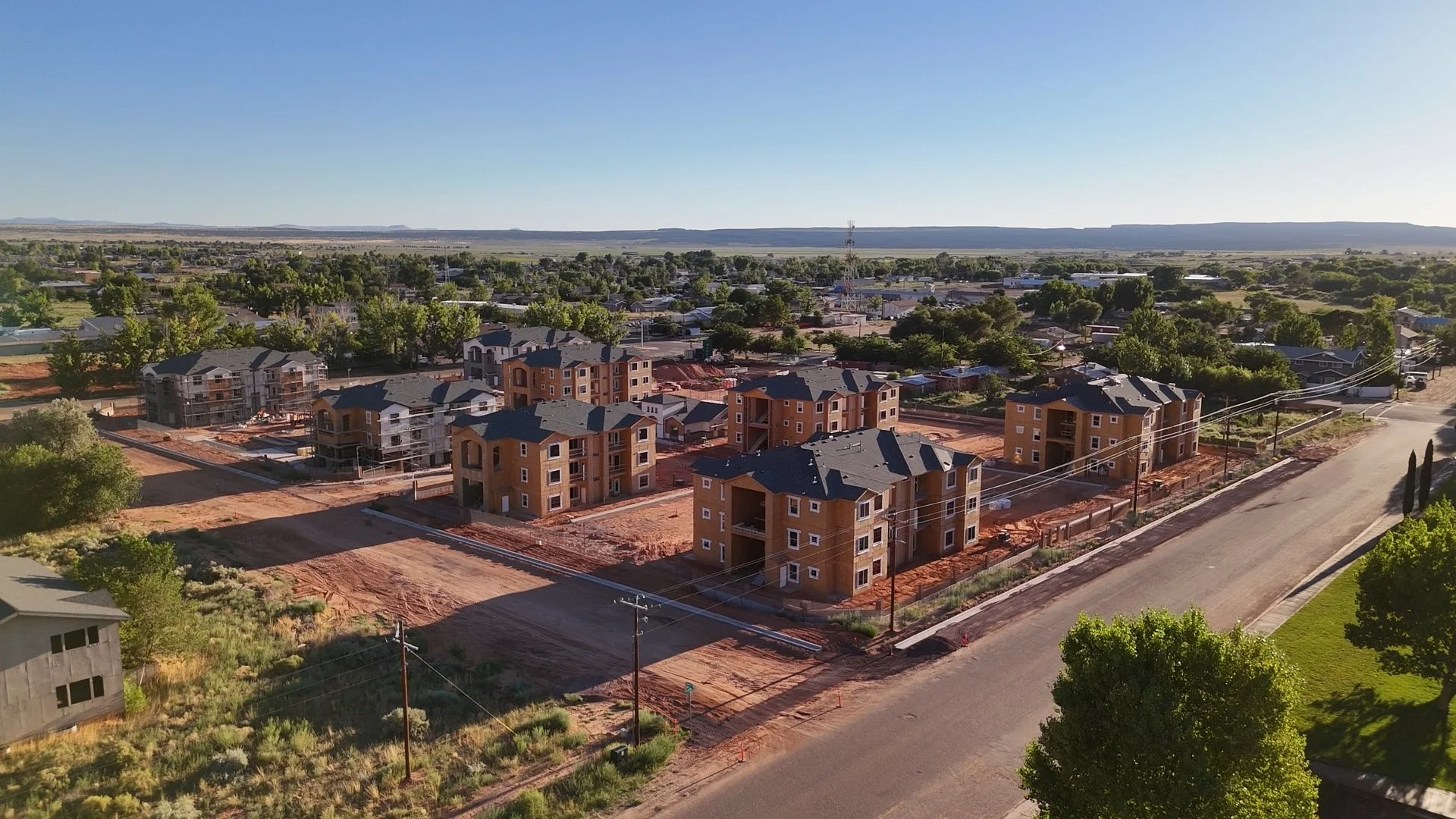
Construction Site Monitoring: A Practical Guide for Project Teams
Construction sites change quickly. Recurring aerial monitoring gives project teams a clear visual record of progress, site conditions, and key milestones. Learn how construction teams use drone imagery to improve visibility, strengthen documentation, and keep stakeholders informed from groundbreaking through closeout.
Construction projects change every day. Materials arrive. Equipment moves. Site access changes. Structures take shape. Work gets covered up. And the people responsible for keeping a project moving aren't always standing in the same place at the same time.
Construction site monitoring creates a consistent visual record of that progress.
Using repeatable aerial imagery and video, project teams can document changing site conditions, track progress over time, communicate with stakeholders, and maintain a visual record from groundbreaking through closeout.
For general contractors, developers, owners, project managers, and other construction stakeholders, the goal isn't simply to get impressive drone footage. It's to make the site easier to understand.
What Is Construction Site Monitoring?
Construction site monitoring is the recurring documentation of a project's conditions and progress throughout construction.
Drone-based monitoring adds an aerial perspective that can be difficult to achieve through ground photography alone. Instead of relying solely on scattered site photos, teams can capture consistent views of the entire project at regular intervals.
Depending on the project, monitoring may take place:
Weekly
Biweekly
Monthly
At major construction milestones
The result is a chronological visual record showing how the project changed over time.
A monitoring program can include high-resolution aerial photography, video, repeatable viewpoints, organized project imagery, geo-referenced deliverables when required, and other project-specific documentation.
The exact scope should be built around what the project team actually needs— not around how much footage a drone can capture.
What Can Construction Teams Use Aerial Monitoring For?
The same imagery can provide value to multiple people involved in a project.
Progress documentation
Regular aerial captures create a visual timeline of construction.
Instead of trying to reconstruct what a site looked like several months earlier, project teams have dated imagery showing conditions throughout the project.
This can be particularly useful before work is covered, altered, landscaped, paved, or otherwise becomes difficult to document later.
Remote site visibility
Not every stakeholder can visit the site every week.
Owners, developers, executives, consultants, and other team members may oversee several projects or work from different locations.
Current aerial imagery gives those stakeholders another way to understand what's happening without requiring another trip to the jobsite.
Drone monitoring isn't necessarily a replacement for site visits. It can make the site visits that do occur more informed and help teams maintain visibility between them.
Stakeholder communication
Construction information can be difficult to communicate through schedules and written reports alone.
A current aerial image can quickly provide context.
Project managers can use visual documentation to support owner updates, internal meetings, presentations, progress reports, and discussions with other stakeholders.
Site logistics
An aerial perspective can make relationships across a site easier to see.
Depending on the project, imagery may help teams observe:
Material staging
Equipment locations
Access routes
Laydown areas
Temporary facilities
Parking and circulation
Changes in site organization
The purpose isn't to replace the judgment of the superintendent or project team. It's to give them another useful perspective.
Historical documentation
One of the most valuable aspects of recurring monitoring may not become apparent until later.
A consistent archive allows teams to look backward.
What was in this location six weeks ago? What did the site look like before this area was paved? When did this condition first appear? What had been completed by a particular date?
Regular documentation creates a visual reference instead of relying entirely on memory or whatever photographs happen to be available.
Why Not Just Take Photos From the Ground?
Ground photography remains important.
But it has limitations.
A person walking a construction site may take dozens or hundreds of photographs, often from different locations and angles each time. Those images can be valuable individually while still making it difficult to understand the project as a whole.
Aerial monitoring provides context.
From above, teams can see relationships between buildings, infrastructure, staging areas, equipment, access points, and surrounding conditions.
Repeatable aerial viewpoints also make comparisons easier.
When similar perspectives are captured over time, a collection of drone images becomes something more useful than a folder of attractive photographs:
a visual timeline of the project.
Drone Monitoring vs. Fixed Construction Cameras
Fixed construction cameras and drones solve different problems.
A fixed camera can provide continuous or frequent imagery from one consistent location. That makes it useful for observing activity over time and creating construction time-lapses.
Drone monitoring provides mobility.
An aircraft can document different areas of a site, capture overhead perspectives, adjust as the project changes, and provide detailed imagery from viewpoints a stationary camera cannot.
For some projects, the best answer may be both.
A fixed camera provides continuous visibility from a known viewpoint while periodic aerial captures provide broader site context and more detailed documentation.
The right approach depends on what the project team needs to see.
How Often Should a Construction Site Be Captured?
There isn't one monitoring schedule that works for every construction project.
The appropriate frequency depends on the pace of construction, project size, reporting requirements, stakeholder needs, and how the imagery will be used.
Weekly monitoring
Weekly capture can work well for fast-moving projects where site conditions change substantially in a short period.
It also creates a detailed visual record and gives remote stakeholders frequent updates.
Biweekly monitoring
For many projects, every two weeks can provide a useful balance between consistent documentation and cost.
There is enough time between captures to see meaningful change while maintaining a relatively detailed project history.
Monthly monitoring
Monthly capture may be appropriate when the goal is broader progress documentation rather than detailed week-to-week comparison.
It can also work well for longer-duration projects or projects with slower visible change.
Milestone-based monitoring
Some teams may prefer captures tied to specific phases, such as:
Existing conditions
Site preparation
Excavation
Foundation
Structural progress
Building enclosure
Major site work
Substantial completion
Final documentation
Projects can also combine approaches—for example, monthly monitoring with additional captures at important milestones.
What Should You Receive After a Monitoring Visit?
A useful construction monitoring program should create predictable deliverables.
Project teams shouldn't have to wonder what they'll receive after each flight.
Depending on the scope, deliverables may include:
High-resolution aerial photographs
Consistent project viewpoints
Overhead imagery
Aerial video
Organized and dated project files
Geo-referenced deliverables where appropriate
Project-specific imagery requested by the team
Consistency matters.
When monitoring is recurring, naming conventions, viewpoints, file organization, and delivery methods should remain as standardized as practical.
The goal is to create information that becomes easier, not harder, to use as the project grows.
What Construction Site Monitoring Does Not Replace
Drone monitoring is a documentation and visibility tool.
It should not automatically be treated as a replacement for engineering inspections, code inspections, safety programs, superintendent site walks, professional land surveying, or other specialized services.
That distinction matters.
The strongest use of aerial monitoring is often as an additional layer of visual intelligence within an existing construction workflow.
It allows teams to see more, document more consistently, and communicate site conditions more clearly.
What About Drone Regulations and Active Jobsites?
Commercial drone operations in the United States must comply with applicable Federal Aviation Administration requirements, and some projects introduce additional operational considerations.
These may include controlled airspace, nearby airports, site safety requirements, equipment movement, cranes, workers, neighboring properties, or other location-specific conditions.
Construction teams shouldn't have to become aviation experts to use aerial monitoring.
A professional drone operator should evaluate the site, coordinate the operation, manage applicable flight requirements, and work with the project team to establish an appropriate capture plan.
How Much Does Construction Drone Monitoring Cost?
Pricing varies because construction sites vary.
Factors can include:
Site size
Location
Flight frequency
Project duration
Required deliverables
Airspace or operational complexity
Travel
Additional processing or documentation requirements
For recurring projects, it often makes more sense to establish a monitoring program than to treat every visit as an unrelated drone shoot.
A project might be structured around weekly, biweekly, monthly, or milestone-based captures for a defined period.
That provides both the construction team and drone operator with a predictable scope—and helps ensure the visual record remains consistent throughout the project.
What Should You Look for in a Construction Monitoring Partner?
Flying a drone is only one part of the job.
Construction teams should consider whether a provider can operate reliably around active projects and produce consistent, useful documentation.
Look for a partner who understands:
Consistency. Can they recreate useful viewpoints and deliver an organized record over months or years?
Safety. Do they approach an active jobsite as an operational environment rather than simply a place to capture footage?
Communication. Can they coordinate efficiently with project personnel without creating unnecessary work for the team?
Deliverables. Are the outputs designed around how the construction team will actually use them?
Scalability. Can the monitoring approach expand across multiple sites if needed?
Ultimately, the value isn't the drone itself.
It's the information the drone helps create.
West Coast Drone Operations provides weekly, biweekly, monthly, and milestone-based aerial monitoring programs built around your project team’s documentation and visibility needs.
Explore Construction MonitoringFrom Groundbreaking to Closeout
Construction site monitoring works best when it is planned early.
Beginning near the start of a project allows teams to establish baseline conditions, select useful viewpoints, determine a capture cadence, and create an organized documentation system that can continue throughout construction.
Over time, individual flights become a visual history of the project.
That record can help project teams understand progress, communicate more effectively, maintain visibility across multiple stakeholders, and preserve documentation of conditions that may no longer exist.
For projects across Southern California and beyond, West Coast Drone Operations provides recurring aerial construction monitoring designed around the needs of project teams—not simply around the flight.
Monitoring programs can be structured around weekly, biweekly, monthly, or milestone-based captures, with deliverables tailored to the project.
When Is Remote Inspection Better Than Traditional Access?
When scaffolding, lifts, confined-space entry or other access requirements make inspection difficult, remote capture can provide another option. Learn when it makes sense and when traditional inspection is still necessary.
Some infrastructure is easy to inspect.
Other assets require lifts, scaffolding, confined-space procedures, shutdowns, specialized access teams, or putting personnel into environments that are simply difficult to reach.
In those situations, the first question doesn't necessarily have to be:
How do we get someone close enough to inspect it?
A better question may be:
What information can we collect remotely before we send someone in?
Drone and remote imaging technologies are increasingly giving facility, infrastructure and engineering teams another way to approach that problem.
They don't eliminate the need for qualified inspectors or hands-on evaluation. But in the right application, remote capture can provide useful visual or sensor data before personnel are exposed to difficult access conditions—and help teams determine where closer investigation is actually necessary.
Why Access Can Become a Major Part of an Inspection
For many assets, collecting the information is only part of the job.
Getting to the asset can require substantial planning.
Depending on the environment, conventional access might involve:
Scaffolding
Lifts or bucket trucks
Rope access
Confined-space entry
Traffic control
Temporary closures
Fall-protection systems
Specialized access personnel
Operational shutdowns
Each can introduce additional cost, scheduling requirements and safety considerations before the inspection itself begins.
This is where remote inspection becomes interesting.
If useful information can be collected without initially putting a person at the point of inspection, teams may be able to make better decisions about where traditional access is actually warranted.
What Is Remote Inspection?
Remote inspection is broader than simply "flying a drone."
Depending on the asset and objective, a remote inspection workflow might involve an aerial drone, an indoor or confined-space platform, ground-based cameras, thermal imaging, acoustic imaging or other specialized sensors.
The technology should be selected around the question the inspection needs to answer.
A conventional high-resolution camera, for example, may be appropriate for documenting visible exterior conditions.
Thermal imaging provides different information.
Acoustic imaging provides something different again.
And some environments may not be appropriate for a drone at all.
The objective should determine the capture method—not the other way around.
1. When Access Creates Additional Safety Exposure
One of the clearest reasons to consider remote inspection is when simply reaching an asset creates additional exposure for personnel.
A roof edge, elevated structural component, enclosed industrial space or difficult-to-access mechanical system may require substantially more safety planning than an asset accessible from the ground.
Remote capture can potentially provide an initial layer of information while personnel remain at a safer location.
That doesn't mean someone will never need to physically access the asset.
It means teams may be able to determine whether physical access is necessary and where it should be focused before taking that step.
2. When Traditional Access Is Expensive
Scaffolding and lifts aren't just access tools.
They're project costs.
If an inspection requires equipment rental, setup, traffic control or specialized personnel, the cost of reaching an asset may exceed the cost of actually evaluating it.
For a large facility or multiple assets, those costs can compound quickly.
Remote imaging can sometimes provide enough preliminary information to narrow the scope of subsequent hands-on work.
Instead of establishing access everywhere, a team may be able to identify specific areas that warrant closer investigation.
3. When Access Disrupts Operations
Inspection work can also interfere with the environment around the asset.
A lift may occupy a roadway or active work area.
Scaffolding may affect building access.
A shutdown may interrupt normal operations.
Traffic control may be required around infrastructure.
In some environments, the operational impact of an inspection can be as important as the inspection cost itself.
Remote capture can be particularly useful when teams need information while minimizing disruption to the surrounding operation.
4. When the Asset Is Large
Scale creates another challenge.
A person inspecting an individual component may have excellent detail but limited context.
Remote imagery can provide a broader perspective.
For facilities and infrastructure teams, that can help answer questions such as:
Where is the condition located relative to the rest of the asset?
Does it appear isolated or repeated?
Which areas should be prioritized for closer review?
How has the condition changed since the previous inspection?
This combination of context and detail is one of the reasons remote capture can be useful even when traditional inspection will ultimately still occur.
5. When Teams Need Repeatable Documentation
Sometimes the objective isn't finding a defect at all.
It's establishing a record.
Infrastructure and facility teams may need to document conditions before construction, after maintenance, following an incident, or at regular intervals.
Repeatable remote capture can help create a visual history of an asset without requiring the same level of physical access every time.
That can be useful for:
Condition documentation
Maintenance planning
Construction monitoring
Before-and-after comparisons
Asset records
Stakeholder communication
Identifying changes that warrant additional investigation
A single inspection tells you what was visible at one point in time.
A consistent series of inspections can help show what changed.
Remote Inspection Doesn't Mean Remote Diagnosis
This distinction matters.
Capturing an image of a condition is not necessarily the same thing as determining its cause.
A drone operator may document a crack, thermal anomaly, unusual surface condition or area of apparent deterioration.
The appropriate engineer, inspector, facility professional or other subject-matter expert may still need to determine:
What is it?
Why is it happening?
Does it represent a problem?
What should be done about it?
That's why we think of remote inspection as part of a larger decision-making workflow:
Capture → organize → identify areas of interest → expert review → targeted follow-up
The value isn't necessarily replacing the expert.
It's giving the expert better information about where to focus attention.
When Traditional Inspection Is Still the Better Choice
Remote inspection isn't appropriate for every project.
Traditional access may still be necessary when the work requires:
Physical measurements
Material sampling
Hands-on testing
Repairs or maintenance
Access behind or inside components that cannot be remotely observed
Code-required inspection procedures
Conditions a remote sensor cannot adequately characterize
Sometimes the correct answer after remote capture is:
Someone needs to go look at this in person.
That's a successful outcome if the remote inspection helped identify exactly where that effort should be directed.
A Real-World Example: Remote Steam Tunnel Inspection
West Coast Drone Operations recently supported an inspection inside a steam tunnel where conventional access presented significant challenges.
The project required visual documentation in a difficult-to-access infrastructure environment. Remote capture allowed imagery to be collected from within the tunnel while reducing the need to place personnel throughout the inspection area.
The resulting information could then be reviewed outside the tunnel and used to support decisions about conditions requiring additional attention.
Read the Remote Steam Tunnel Inspection Case Study →
This is exactly the kind of application where remote inspection makes sense—not because a drone is inherently better than a person, but because access itself is part of the problem.
Questions to Ask Before Choosing an Inspection Method
Before deciding whether remote capture is appropriate, start with the asset and the information you need.
Ask:
What are we trying to observe or document?
How difficult is the asset to access conventionally?
What safety measures would physical access require?
Would accessing the asset disrupt operations?
What level of visual or sensor detail is required?
Does the inspection require physical contact, testing or sampling?
Who will interpret the collected information?
What happens after an area of interest is identified?
Those answers should determine whether remote inspection, conventional access or a combination of both is appropriate.
The Goal Isn't to Replace the Inspector
The most useful way to think about remote inspection isn't:
Drone versus human.
It's:
Where is human expertise most valuable?
Highly trained engineers, facility professionals and inspectors shouldn't necessarily have to spend their time performing every element of routine data collection if some of that work can be performed remotely.
Remote technologies can help separate collecting information from interpreting information.
In the right application, that means subject-matter experts can spend more of their time reviewing conditions, making decisions and focusing physical inspection on the places where their expertise is actually required.
For some assets, aerial capture can provide the visual documentation teams need before committing to lifts, scaffolding, roof access, or other more involved inspection methods. Tell us what you need to inspect, and we'll help evaluate whether a drone-based approach makes sense.
Discuss Your Inspection →Remote Inspection Services in Southern California
West Coast Drone Operations supports infrastructure, facility and commercial teams with aerial and remote visual data collection across Southern California.
Our capabilities include high-resolution visual capture, thermal imaging, mapping and specialized remote inspection workflows designed around the asset and the information the project team needs to collect.
We don't begin with the aircraft.
We begin with the question:
What do you need to understand, and what's the safest, most efficient way to see it?
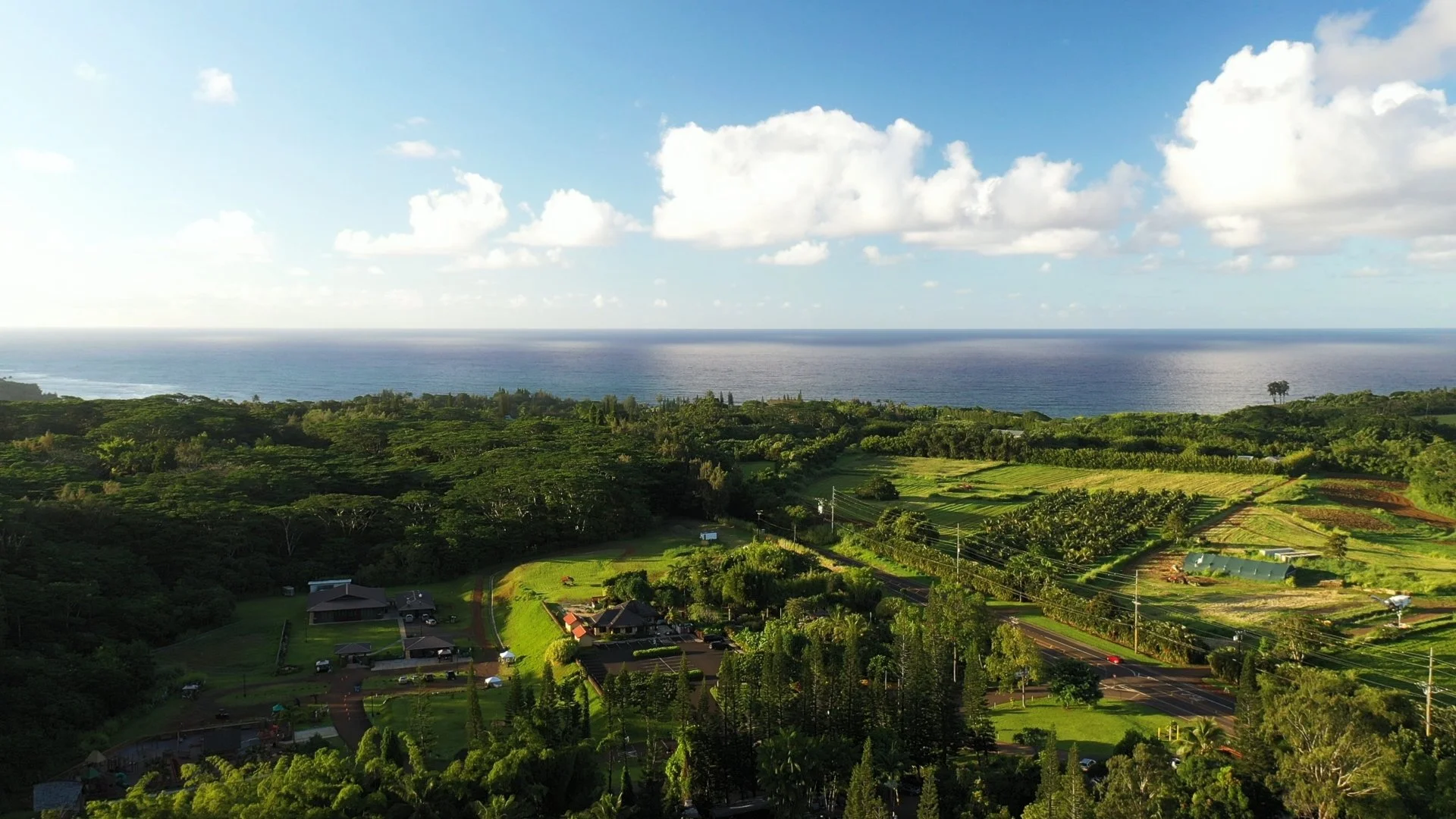
How Marketing Agencies Can Get More Content From a Single Drone Shoot
One aerial production can create far more than a hero shot. Learn how marketing agencies and brands can plan drone shoots to build a full library of reusable visual assets for websites, social media, advertising, and future campaigns.
Marketing teams are under pressure to produce more content across more channels— often without a corresponding increase in production budgets.
A campaign may need a website hero, social video, paid advertising creative, still imagery, vertical content, presentation assets and behind-the-scenes material. Yet production is often planned around one primary deliverable.
That can leave valuable content on the table.
A well-planned aerial production can work differently.
Instead of approaching a drone shoot as a request for a handful of aerial shots, agencies and in-house marketing teams can plan it as a content capture opportunity, one designed to generate a library of visual assets that can be used across a campaign.
The difference starts before the drone ever leaves the ground.
Think Beyond the Hero Shot
There will usually be one shot everyone wants.
Maybe it's a sweeping reveal of a new development, an aerial approach to a corporate campus, a tracking shot of a vehicle or an overhead view of an event.
Capture it.
But don't build an entire production around that shot alone.
Before filming, consider all of the places the organization needs visual content.
That might include:
Website headers and landing pages
Instagram and Facebook
LinkedIn
YouTube
Paid social advertising
Digital display campaigns
Sales presentations
Internal communications
Recruiting materials
Event screens
PR and media outreach
Future campaigns
Suddenly, the objective changes.
You're not simply asking:
What shot do we need?
You're asking:
What visual library can we create while we're already there?
Start With the Campaign, Not the Drone
This is one of the most important distinctions between a production-oriented drone partner and someone simply capturing aerial footage.
The aircraft shouldn't dictate the creative.
The campaign should.
Before production, identify the audiences, platforms and messages the footage needs to support.
For example, imagine an agency is creating a campaign for a commercial real estate development.
The primary deliverable may be a 60-second brand video.
But the same production might also capture:
Wide establishing footage for the website.
Movement through the property for the campaign film.
Short visual sequences for social posts.
Clean environmental imagery for LinkedIn.
Vertical compositions for Reels and Stories.
High-resolution aerial stills for presentations and digital marketing.
Location context showing how the property relates to its surroundings.
That's substantially more useful than receiving a folder containing five variations of essentially the same aerial shot.
Capture for Multiple Aspect Ratios
One of the easiest ways to limit the lifespan of footage is to think about format after the shoot.
Digital campaigns now routinely require content in several orientations.
A cinematic 16:9 composition may look excellent on a website or YouTube but become difficult to repurpose into 9:16 vertical video.
Likewise, a composition designed specifically for a vertical social frame may not work well across a wide website banner.
That doesn't mean every shot needs to work everywhere.
It means the shot list should anticipate where the content will live.
Before production, identify whether the campaign requires:
16:9 — websites, YouTube, presentations and traditional video
9:16 — Reels, Stories, Shorts and other vertical placements
1:1 or 4:5 — social feeds and paid social placements
Then plan compositions with those outputs in mind.
A little planning during capture can dramatically increase how much usable content comes out of the production.
Capture Sequences, Not Just Shots
A beautiful drone shot can get someone's attention.
A sequence gives an editor options.
Rather than thinking exclusively in isolated hero shots, consider capturing complementary perspectives:
Establishing → medium → detail
or
Approach → reveal → departure
or
Exterior context → subject → surrounding environment
This gives editors material that can be assembled differently depending on the platform.
A 30-second campaign edit might use the full sequence.
A six-second ad may use only the reveal.
A social post may use the detail.
A website may use the establishing shot without any edit at all.
The same production suddenly supports multiple creative executions.
Don't Forget Aerial Stills
Video tends to dominate conversations about drone production, but high-quality still photography can substantially increase the value of a shoot.
Still imagery may support:
Websites
Social posts
Digital advertising
PR
Presentations
Proposals
Reports
Sales materials
Event graphics
And unlike a finished video, an image can often be reused for years.
For B2B organizations in particular, building an original image library can solve an ongoing marketing problem: the constant need for relevant visual assets that don't look like stock photography.
Capture Evergreen Content Alongside Campaign Content
Campaign-specific material has an expiration date.
Evergreen content doesn't necessarily have one.
When practical, agencies should use production days to capture both.
For example, a company may commission aerial production around a new facility opening.
Obviously, the team should capture the opening.
But it may also be worth capturing clean footage of:
the facility exterior,
the surrounding property,
operations,
vehicles or equipment,
employees where appropriate,
architectural details, and
the broader location.
Months later, the launch campaign may be over.
Those assets can still be useful for the company's website, recruiting, sales presentations, LinkedIn content and future campaigns.
That's where production begins to function as content infrastructure, rather than a one-time expense.
Build a Content Library the Client Can Actually Use
Capturing more isn't automatically better.
If an agency receives hundreds of vaguely named video files with no organization, the additional footage may never be used.
A useful content library should make it relatively easy to find what was captured.
Depending on the project, footage might be organized around:
Location
Subject
Shot type
Campaign
Date
Orientation
Intended use
The objective is simple:
Six months after the shoot, someone should be able to find an appropriate piece of footage without having to remember which memory card it came from.
For agencies, this becomes even more valuable when the library is transferred to the client after a campaign.
Aerial Content Doesn't Have to Look Like "Drone Content"
This is an important creative consideration.
Not every aerial shot needs to be a dramatic, high-altitude landscape.
Drones can also create movement and perspectives that simply feel like part of a polished production.
Depending on the location and production requirements, that might mean:
a slow architectural movement,
a low tracking shot,
a gradual reveal,
a top-down composition,
a transition between environments, or
a perspective that connects a subject to its surroundings.
The viewer doesn't necessarily need to think:
That's a drone shot.
Ideally, they think:
That's a compelling image.
The technology should serve the creative rather than become the creative.
Where Agencies Can Get More Value From Aerial Production
Some types of clients are especially well suited to building reusable aerial libraries.
Construction + Real Estate
Aerial capture can document both the project and its environment while providing material for development marketing, corporate communications and social content.
Hospitality + Destinations
Properties, resorts, attractions and destinations benefit from imagery that establishes a sense of place and scale.
Automotive
Movement, location and environment can all become part of the visual story, creating material for brand campaigns and shorter digital executions.
Corporate + Industrial
Facilities and operations can be difficult to communicate visually from the ground.
Aerial perspectives can establish scale and context while providing imagery for websites, recruiting, internal communications and B2B marketing.
Events
Aerial imagery can establish attendance, environment and scale while supplementing ground production.
Each requires a different creative approach.
That's why the production conversation should begin with the client's marketing objectives—not simply a request for "some drone footage."
Should an Agency Hire a Drone Operator or a Production Partner?
Sometimes an agency genuinely needs a pilot to execute a defined shot list.
That's perfectly reasonable.
Other projects benefit from someone who can participate earlier in the production process.
A production-minded aerial partner can help think through:
What should we capture while we're there?
Which shots can serve multiple deliverables?
What will editors need later?
Which formats should we anticipate?
What can we capture now that the client may need six months from now?
That planning can make the difference between buying a few shots and building a useful collection of brand assets.
Make the Production Budget Work Harder
Getting more value from a drone shoot doesn't necessarily mean flying longer.
Often, it means planning better.
Know the platforms before the shoot.
Know the deliverables.
Think about horizontal and vertical applications.
Capture sequences rather than isolated shots.
Collect stills where appropriate.
Look for evergreen material.
And think beyond the immediate campaign.
The objective isn't simply to leave production with more files.
It's to leave with more usable content.
West Coast Drone Operations works with agencies, production teams, and brands to capture aerial footage built around the creative, technical, and logistical needs of the project. Bring us in for the aerial component or as part of a broader production workflow.
Discuss Your Production →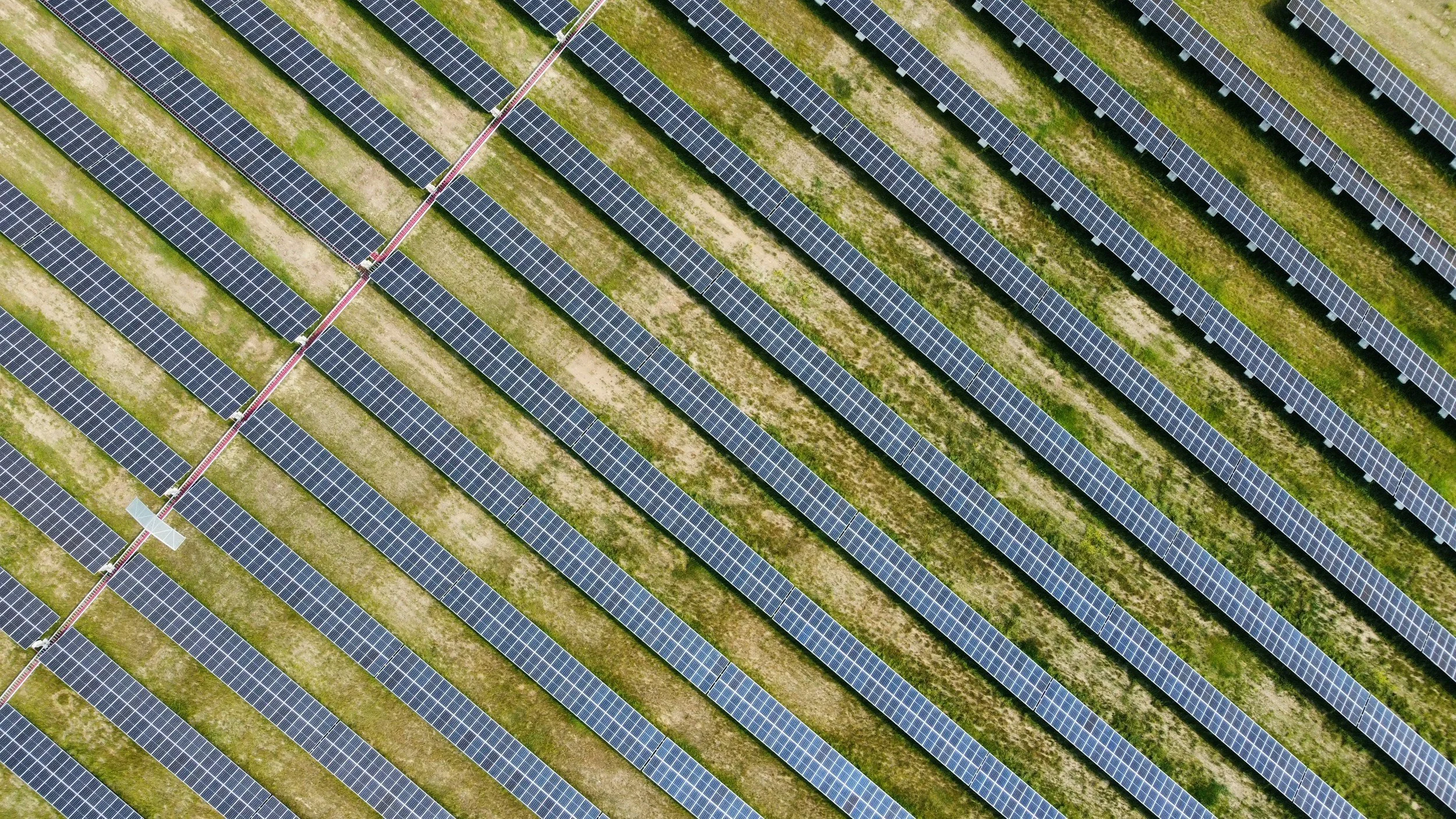
Drone Solar Inspections & Mapping: What Solar Operators Can Learn From Aerial Data
Utility-scale and commercial solar sites require more than just impressive aerial photos— they demand targeted, actionable data. Discover how solar developers, construction teams, and O&M operators leverage precision mapping, visual progress tracking, and thermal inspections across California assets.
Utility-scale and commercial solar sites present a simple challenge: a lot of infrastructure is spread across a lot of ground.
As solar assets grow in size, understanding site conditions from ground level alone can become time-consuming. Construction teams need visibility into progress. Operators need ways to document changing conditions. Asset managers may need a broader view of an entire property before deciding where closer investigation is warranted.
Drone-based aerial data can provide that perspective.
From high-resolution visual documentation and mapping to more specialized thermal inspection, aerial platforms can help solar teams collect information across large sites efficiently.
But not every "solar drone inspection" is the same.
The right approach depends on a much more important question:
What does your team actually need to know?
Where Do Drones Fit Into the Solar Lifecycle?
Aerial data can support a solar project at multiple stages, and the appropriate deliverable changes as the project moves from development into operation.
A construction team documenting installation progress has very different needs from an O&M team investigating underperforming modules.
Understanding those differences is important before deciding what equipment, sensors or flight program a project requires.
1. Site Mapping & Existing Conditions
Before or during development, aerial capture can provide a broad visual record of a project site and its surrounding conditions.
Depending on the project requirements and capture methodology, aerial data may support:
Site mapping
Existing-condition documentation
High-resolution overhead imagery
Access and roadway documentation
Equipment and infrastructure locations
Site context and surrounding conditions
Repeatable visual records
The advantage is perspective.
Instead of examining isolated portions of a large property, project teams can see how individual elements relate to the entire site.
More specialized mapping requirements may require appropriate positioning, processing, ground control or other workflows. Aerial photography alone should not automatically be treated as survey-grade data.
2. Solar Construction Progress Monitoring
Once construction begins, repeatable aerial capture can create a visual record of the project as it develops.
Flights can be scheduled around major milestones or performed on a recurring basis to document changes over time.
Aerial imagery may help teams visualize:
Site preparation → racking → module installation → electrical infrastructure → site completion
That record can be particularly useful for project managers, developers, owners and other stakeholders who aren't continuously on site.
Consistent capture matters here.
Flying from similar locations and perspectives over time makes it easier to compare conditions between visits rather than simply creating a new collection of attractive aerial photographs each time.
3. Large-Site Visual Documentation
Once a solar asset is operational, aerial imagery can provide a broad view of physical conditions across the property.
High-resolution visual capture can help document visible conditions involving areas such as:
Panel arrays
Rows and racking
Access roads
Fencing and perimeter conditions
Vegetation
Drainage or standing water
Equipment areas
Surrounding property conditions
This doesn't mean a conventional camera can diagnose every problem with a solar array.
It means operators can gain another layer of visibility across a site and use that information to determine where more targeted investigation may be appropriate.
4. Thermal Inspection
Thermal imaging introduces a different capability.
Solar modules generate electrical energy, and certain faults or abnormal operating conditions can produce temperature differences that may be detectable with appropriate thermal equipment.
A properly designed aerial thermal inspection may help identify thermal anomalies across a large array, allowing teams to focus subsequent investigation on particular modules or areas rather than treating every part of the site equally.
Potential observations can include temperature patterns associated with conditions that warrant closer examination.
But there's an important distinction:
A thermal anomaly is a finding— not automatically a diagnosis.
Temperature differences can have multiple causes. Environmental conditions, system state, irradiance, equipment, flight parameters and inspection methodology all affect the usefulness of thermal data.
The appropriate solar or electrical professional may still need to determine why an anomaly exists and what corrective action, if any, is necessary.
That is why thermal solar inspection should be treated as a technical data-collection process rather than simply flying a thermal camera over a solar field.
5. Targeting Ground Inspection & Maintenance
One of the most compelling applications of aerial data isn't replacing people.
It's helping people determine where their attention is needed most.
Imagine an O&M team responsible for a large solar site.
Without additional information, technicians may need to investigate a substantial amount of equipment from the ground.
Aerial visual or thermal data can potentially help narrow the field:
Here are the areas that appear normal.
Here are the areas showing something unusual.
Here are the locations that warrant closer investigation.
The qualified personnel responsible for the asset can then evaluate those locations directly.
This is a useful way to think about drone inspection generally:
remote data collection → identify areas of interest → targeted investigation → informed maintenance decision
6. Recurring Asset Documentation
A single flight provides a snapshot.
Repeated capture creates a record.
For operators managing assets over many years, recurring aerial documentation can provide visual evidence of how site conditions change over time.
That may be useful for documenting:
Vegetation changes
Site access
Drainage conditions
Physical deterioration
Storm or weather impacts
Construction or maintenance activity
Changes around equipment and infrastructure
The appropriate frequency depends on the asset and operational need.
Some sites may benefit from scheduled recurring capture. Others may need aerial documentation around particular events, maintenance cycles or suspected issues.
More flights aren't automatically better.
The goal is to collect information when it is likely to be useful.
Mapping, Visual Inspection and Thermal Inspection Aren't Interchangeable
This distinction is especially important when evaluating solar drone providers.
Someone saying, "We can fly your solar farm," doesn't tell you very much.
Different objectives require different workflows.
Visual documentation uses conventional high-resolution imagery to document visible site and asset conditions.
Mapping uses systematically captured imagery and processing to create spatially organized representations of the site.
Thermal inspection uses infrared imaging and an appropriate inspection methodology to identify temperature variations or anomalies.
A project may require one of these.
It may require several.
But the inspection should begin with the operational objective, not with whichever sensor happens to be mounted on the aircraft.
What Should Solar Teams Ask Before Hiring a Drone Provider?
Before establishing an aerial program, clarify what success looks like.
Ask:
Are we documenting construction or inspecting an operating asset?
Do we need visual imagery, mapping, thermal data or some combination?
How large is the site?
Will the same areas need to be compared over time?
Who will review the resulting data?
How precisely do observations need to be located?
What happens after an anomaly or condition is identified?
How should deliverables integrate into the team's existing workflow?
Those answers influence everything from aircraft and sensor selection to flight planning and reporting.
What Should the Deliverable Look Like?
The value of an aerial program doesn't end when the aircraft lands.
A solar team needs to be able to use what was collected.
Depending on scope, deliverables might include:
High-resolution aerial imagery
Organized site photography
Video documentation
Orthomosaic or mapping products
Geo-referenced deliverables
Thermal imagery
Identified areas of interest
Repeatable progress documentation
Project-specific reporting
The exact deliverable should be determined before capture begins.
A large collection of unlabeled imagery isn't necessarily actionable data.
Start With the Asset, Not the Aircraft
Drone technology can make data collection across large solar sites considerably more practical.
But the aircraft itself isn't the strategy.
The better questions are:
What information does the asset team need?
What decisions will that information support?
How frequently does it need to be collected?
What level of accuracy or analysis is required?
Who needs to receive the results?
Answer those questions first.
Then build the aerial program around them.
Aerial imagery and inspection data can help solar teams document site conditions, monitor progress, review large areas efficiently, and support ongoing asset management. Tell us what you need to inspect, map, or document, and we'll help scope the right aerial approach.
Discuss Your Solar Project →
Navigating the SoCal Climate: How Drone Inspections Can Accurately Evaluate Building Envelopes & Roofs
Inspecting commercial building envelopes and flat roofs in Southern California comes with a unique challenge: the weather. Learn why off-the-shelf thermal scans fail on SoCal facades, and how combining post-sunset radiometric roof scans with high-magnification RGB facade mapping delivers accurate, building-science-backed data.
Inspecting commercial building envelopes and flat roofs in Southern California comes with a unique environmental challenge: the weather. With mild coastal climates and minimal indoor-to-outdoor temperature differentials, relying on daytime thermal imaging alone often fails to deliver actionable data on regional facades.
Executing accurate commercial asset inspections across Los Angeles, Long Beach, and Orange County requires an operational hybrid approach, combining post-sunset radiometric thermal imaging for roofs with high-magnification visual (RGB) spatial mapping for facades and structural envelopes.
Why SoCal Climate Requires a Specialized Flight Strategy
In colder regions, indoor heating creates a sharp temperature differential against freezing exterior air, making heat loss and moisture leaks pop instantly on a thermal camera. In Southern California, where ambient outdoor temperatures hover near interior thermostat settings, capturing clear data requires precise timing and multi-sensor capabilities:
High-Rise Facades
Environmental Challenge: Low temperature differentials and heavy solar reflection off glass, stucco, and metal cladding.
Practical Solution:High-Magnification 4K RGB & 3D Mesh. Zoom optics capture sealant decay, concrete spalling, and hairline cracking without relying on thermal signatures.
Commercial Flat Roofs
Environmental Challenge: Direct daytime sun creates solar loading, masking subsurface moisture pockets.
Practical Solution:Post-Sunset / Pre-Dawn Thermal Scans. Flying after dark allows radiometric sensors to detect residual heat retained by trapped moisture as the roof surface cools.
The Two-Pronged Inspection Workflow
1. High-Resolution Visual (RGB) Surveys for Building Envelopes
To evaluate exterior walls, windows, and structural flashing without relying on heat differentials, drone operators utilize high-resolution RGB sensors with multi-angle flight paths.
Defect Identification: High-magnification zoom pinpoints sealant degradation, loose cladding, window frame gaps, and concrete spalling.
3D Photogrammetry Models: Overlapping imagery generates geo-referenced 3D mesh models (.OBJ) and orthomosaics, allowing structural engineers to measure surface defects down to the millimeter from their desktop.
2. Night-Time Radiometric Thermal Surveys for Roof Membranes
While daytime thermal scans struggle on SoCal facades, post-sunset thermal imaging on commercial roofs remains unmatched for moisture detection.
Solar Dissipation Effect: As the sun goes down, dry roofing materials cool off rapidly. Trapped moisture beneath the membrane retains thermal energy much longer.
Pinpoint Mapping: Radiometric thermal cameras map exact wet insulation boundaries, allowing repair crews to execute targeted patch repairs rather than full, expensive roof replacements.
Navigating Controlled Airspace Across Greater Los Angeles
Deploying drones after dark or near major transportation hubs requires strict regulatory oversight. Much of Southern California’s commercial real estate sits within Class D controlled airspace near regional airports like Long Beach (LGB), John Wayne (SNA), and LAX.
Executing compliant flights demands FAA Part 107-certified pilots with nighttime flight authorization and the ability to coordinate rapid LAANC clearances or formal FAA waivers. Combining regulatory fluency with deep high-access building experience ensures every mission satisfies local municipality rules, site safety protocols, and airspace boundaries.
Frequently Asked Questions
Why can't thermal cameras inspect building facades during the day in SoCal?
Daytime solar loading heats up the building's outer skin, masking internal thermal anomalies. Additionally, SoCal's mild climate rarely creates the indoor/outdoor temperature gap needed for daytime wall scans.
What deliverables do structural engineers receive from a hybrid drone survey?
Engineers receive high-resolution RGB defect maps, 3D CAD-compatible point clouds (.LAS/.LAZ), and radiometric thermal overlay files calibrated with exact GPS coordinates.
Aerial thermal and high-resolution visual capture can help building owners, facility teams, and property managers document conditions across roofs and exterior building envelopes while reducing the need for some difficult or elevated access.
Discuss Your Inspection →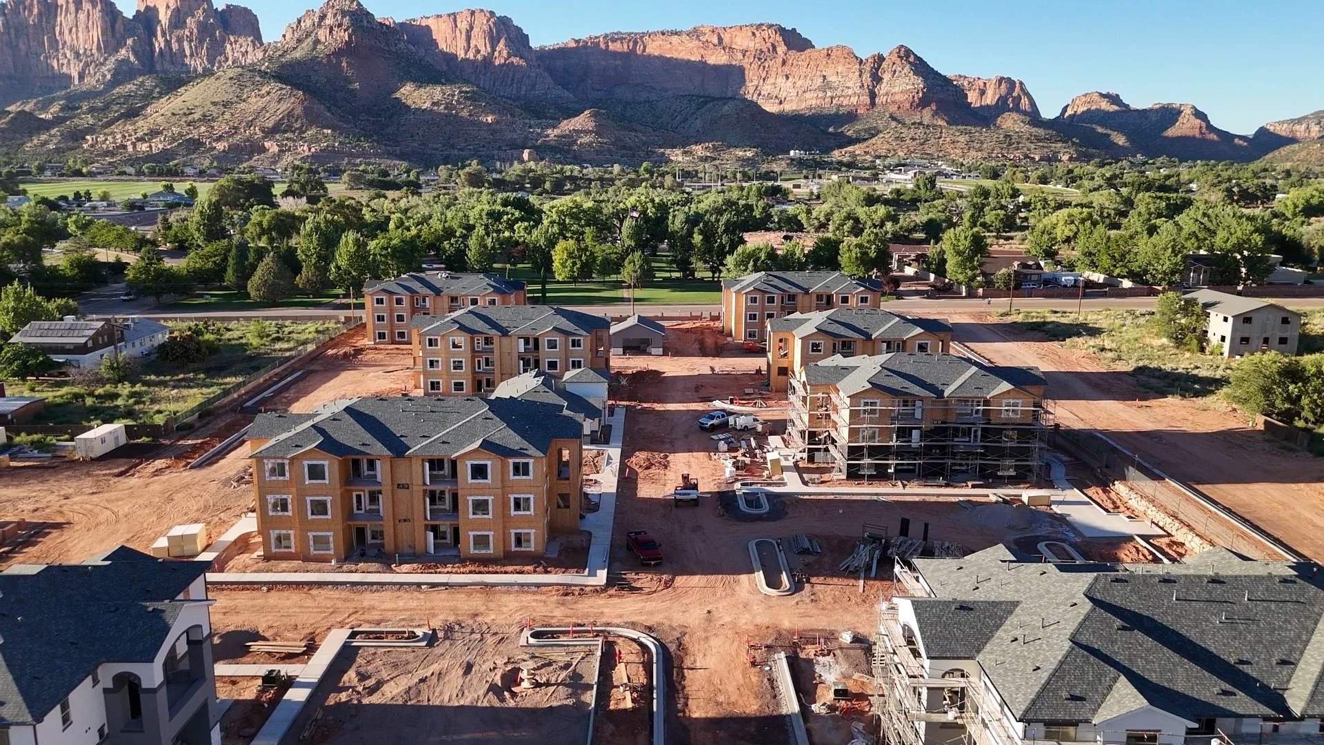
What Can Drone Construction Monitoring Actually Tell You?
Drone construction monitoring can provide project teams with a consistent visual record of site progress, changing conditions and hard-to-see areas. Here's what aerial documentation can (and can't) tell you.
Construction teams have more ways than ever to capture information from a jobsite. Drones can provide an expansive view of a project quickly, create a visual record of changing conditions, and help teams see areas that may be difficult to understand from ground level alone.
But what can drone construction monitoring actually tell you?
And just as importantly: what can't it tell you?
For contractors, developers, owners and project teams considering aerial documentation, understanding that distinction is important. Drone imagery is most valuable when it is collected with a clear purpose and delivered in a format that helps the project team make better-informed decisions.
What Is Drone Construction Monitoring?
Drone construction monitoring is the recurring capture of aerial imagery or data throughout the lifecycle of a construction project.
Rather than commissioning a single aerial shoot, a project team establishes a capture schedule—weekly, monthly, at key milestones or according to another project-specific cadence.
Over time, those flights create a consistent visual record of how the site changes.
Depending on the project's needs and the type of data being collected, aerial monitoring can support everything from progress documentation and stakeholder communication to site planning and more specialized inspection workflows.
The important word is consistent.
A collection of beautiful aerial photographs may be useful for marketing. Construction monitoring becomes much more operationally valuable when imagery is captured intentionally and repeatedly so conditions can be compared over time.
1. A Clearer View of Overall Site Progress
One of the simplest advantages of aerial imagery is perspective.
A large construction site can be difficult to understand from ground level. Individual crews may have excellent visibility into their respective areas while owners, executives or other stakeholders need a broader picture.
Aerial capture can show:
Overall site development
Building footprints and major site features
Changes in active work areas
Material and equipment placement
Access routes and staging areas
Progress across multiple portions of a project
Repeated flights make that perspective more useful because teams aren't simply seeing what the site looks like today. They're building a record of how it has changed.
2. Progress Between Project Milestones
Construction doesn't always progress in ways that are obvious from a schedule or written status report.
Recurring aerial documentation can provide a visual companion to traditional project reporting.
For example, imagery captured at consistent intervals can help illustrate changes in:
Site preparation → foundations → structural work → exterior development → site improvements → completion
That record can be useful for project teams reviewing progress internally and for communicating with stakeholders who aren't regularly on site.
The goal isn't to replace project management systems.
It's to give those systems something they often can't provide on their own: a visual record of the physical project.
3. Conditions That Are Hard to See From the Ground
Construction sites are three-dimensional environments.
Roof areas, elevations, large structures and expansive sites can contain conditions that aren't easily understood from one ground-level vantage point.
Aerial imagery can provide additional perspective on areas such as:
Roof and exterior conditions
Building envelopes
Elevated structures
Site perimeters
Large material or equipment areas
Difficult-to-access portions of a project
In some cases, higher-resolution imagery can also allow teams to review specific areas after the flight rather than relying solely on what someone happened to observe while walking the site.
That ability to capture now and examine later is an important part of the value.
4. A Historical Visual Record
Construction conditions change quickly.
Something visible today may be covered, moved or altered a week later.
Recurring aerial documentation creates a timestamped visual record of the project at different stages of development.
That archive can help teams revisit questions such as:
What did this portion of the site look like at that stage?
When did this condition become visible?
How did this area change between two project milestones?
What was present before subsequent work occurred?
The value of that archive often becomes clearer later in a project, when earlier conditions can no longer be observed directly.
5. Better Communication With Off-Site Stakeholders
Not everyone involved in a construction project can—or needs to—visit the site regularly.
Owners, investors, executives, consultants and other stakeholders may need enough visibility to understand progress without walking the jobsite themselves.
Aerial imagery can make complex projects easier to communicate.
Instead of relying exclusively on written descriptions, teams can provide a visual overview that quickly establishes context:
Here is the entire project.
Here is where work is happening.
Here is what changed since the previous capture.
For teams managing multiple projects or stakeholders in different locations, that can be particularly useful.
6. Documentation for Meetings and Reporting
Aerial imagery doesn't have to exist as a standalone deliverable.
It can support existing project workflows.
Images and video may be incorporated into:
Progress reports
Internal project meetings
Owner updates
Presentations
Planning discussions
Project documentation
This is why it's important to determine how the imagery will actually be used before establishing the capture program.
A superintendent may need something very different from a marketing team.
An owner overseeing multiple sites may need something different again.
The capture strategy should reflect those needs.
Can Drone Monitoring Improve Construction Site Safety?
This is an area where precise language matters.
Aerial imagery can provide additional visibility into site conditions and allow teams to review certain areas without requiring someone to physically access them simply to obtain a visual perspective.
It may also document conditions that qualified project or safety personnel want to review.
But drone monitoring is not a substitute for a construction safety program, qualified safety personnel or required inspections.
A drone operator should not turn an aerial photograph into an unsupported safety determination.
Instead, think of aerial capture as another source of visual information that the appropriate project professionals can use within their existing workflows.
That distinction is especially important when selecting a drone provider.
What Drone Construction Monitoring Can't Tell You
Drone imagery can be powerful, but it has limitations.
A conventional RGB camera cannot automatically tell you whether a structure is engineered correctly, whether work complies with applicable codes, whether a particular installation meets specifications or whether a site is "safe."
Those determinations may require engineers, inspectors, safety professionals, testing or other specialized expertise.
Likewise, not every aerial image is automatically a map or measurement-grade dataset.
Different outcomes require different capture methods, equipment, positioning accuracy, processing and workflows.
A good drone provider should be willing to tell you what the data can support—and what it can't.
What Should You Ask a Drone Provider Before Starting?
Before establishing a recurring construction monitoring program, start with the desired outcome rather than the flight itself.
Ask:
What are we trying to document?
Who will use the imagery?
How frequently will conditions need to be captured?
Do we need photography, video, mapping or another type of data?
Which perspectives need to remain consistent between flights?
How quickly do project teams need access to the deliverables?
How will the imagery be organized over the life of the project?
Those questions help determine the appropriate flight plan, equipment, frequency and deliverables.
Consistency Matters More Than Flying More Often
More flights don't automatically create more value.
For some projects, weekly capture may make sense. Others may benefit from monthly flights or documentation at predetermined milestones.
What matters is establishing a cadence that corresponds to meaningful changes on the project.
Consistency in where, how and when imagery is captured can also make comparisons much easier.
If the goal is to document progress over time, repeatedly capturing similar perspectives can be substantially more useful than creating an entirely different set of cinematic shots during every visit.
Cinematic footage has its place—especially for stakeholder communications and marketing—but operational documentation should be designed for repeatability.
What Should the Deliverable Look Like?
There isn't one correct answer.
A relatively straightforward monitoring program might provide organized high-resolution aerial photographs and video at predetermined intervals.
Other projects may require more specialized deliverables, such as geo-referenced imagery, mapping products or inspection-focused capture.
The right deliverable depends on what the project team needs to do with the information.
The important part is avoiding a common mistake:
Don't collect large amounts of aerial data without deciding how someone will use it afterward.
A smaller, well-organized set of useful imagery can be far more valuable than hundreds of files nobody knows how to navigate.
Start With the Construction Problem, Not the Drone
Drones are increasingly common on construction sites, but simply adding a drone doesn't create an effective monitoring program.
Start instead with the project team's questions.
What do we need to see?
What changes do we need to document?
Who needs that information?
How frequently will they use it?
What decisions should the imagery help support?
Once those questions are clear, the aerial capture program can be designed around them.
That is where drone construction monitoring becomes more than photography.
It becomes part of the project's visual documentation strategy.
Every project has different visibility, documentation, and reporting needs. Answer a few quick questions about your project to explore where recurring aerial monitoring could add value and what approach may make sense.
Take the Aerial Opportunity Assessment →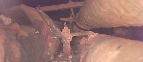
How to Inspect Inaccessible Infrastructure Without Sending Personnel Into Confined Spaces
When critical infrastructure is difficult or impractical to access, remote inspection can help teams document conditions, investigate suspected problems and determine where further evaluation or repair may be needed.
Aging infrastructure often presents a difficult problem: the areas that most need inspection can also be the hardest, or least practical, for personnel to access.
Utility tunnels, pipe corridors, industrial spaces and other confined environments may contain deteriorating infrastructure, suspected leaks or conditions that require investigation. But sending personnel into those environments can introduce additional safety requirements, operational complexity and downtime.
Remote inspection technologies offer another way to approach the problem.
By combining remotely captured visual data with specialized sensing technologies, infrastructure teams can investigate conditions, document potential areas of concern and determine where more targeted evaluation or repair may be warranted—without requiring personnel to physically enter every environment being assessed.
What Is a Remote Infrastructure Inspection?
Remote infrastructure inspection uses cameras, remotely operated equipment and, when appropriate, specialized sensors to collect information from areas that are difficult or impractical to access directly.
The objective isn't simply to capture video.
A useful inspection is designed around a specific operational question:
What does the facility team need to know in order to make the next decision?
Depending on the project, remote inspection may help teams:
Document visible infrastructure conditions
Examine pipes, valves, supports and structural components
Identify corrosion, cracking, moisture or deterioration
Investigate suspected leak areas
Record conditions at specific locations or distances
Create a visual record for engineering, maintenance or repair teams
Narrow a large area of infrastructure into locations that warrant closer investigation
The technology used should follow the inspection objective—not the other way around.
When Does Remote Inspection Make Sense?
Not every difficult inspection requires a remote system. But it becomes particularly valuable when physical access introduces significant complications.
Confined or restricted spaces
Utility tunnels and industrial spaces may have limited clearances, difficult entry conditions or geometry that makes conventional inspection challenging.
Remote cameras can allow teams to examine portions of these environments without requiring personnel to travel through the inspection area.
Suspected leaks
A facility may know that a system is losing steam, water or another material without knowing precisely where the problem originates.
Remote visual inspection can reveal visible clues such as moisture, staining, deposits, cracking or deterioration.
Other sensing technologies can add another layer of information.
Aging infrastructure
Corrosion doesn't always occur at one obvious failure point.
Remote documentation can reveal broader patterns across pipes, supports, valves, brackets, fasteners and surrounding infrastructure that may be useful for maintenance planning.
Areas where access would disrupt operations
In some environments, gaining conventional access can require shutdowns, specialized entry procedures or other operational accommodations.
Remote inspection may help teams gather preliminary information and better target subsequent work.
Visual Inspection Is Only Part of the Picture
A camera can tell you a great deal about physical condition.
It may reveal corrosion, cracks, standing water, damaged insulation, deposits, deteriorated hardware or other visible abnormalities.
But some infrastructure problems aren't readily visible.
That's where combining remote visual inspection with other sensing technologies can become particularly useful.
For example, ultrasonic acoustic imaging can detect sound patterns associated with turbulent pressurized flow. When investigating a suspected steam leak, that information can be compared with visual findings to help identify an area that warrants further attention.
It's important to understand the limitation, however.
An acoustic indication does not necessarily identify the precise point of failure or determine the size of a leak. Instead, it provides another source of evidence that can be evaluated alongside visual conditions and other facility information.
That distinction matters.
The goal of remote inspection should be to provide useful, defensible information for the next decision, not to claim more certainty than the collected data supports.
A Real-World Example: Investigating a Steam Distribution Tunnel
West Coast Drone Operations recently supported an inspection of a steam distribution system for ENFRA Solutions.
A suspected steam leak needed to be investigated within a utility tunnel where tunnel geometry and confined-space conditions prevented personnel from entering the inspection area.
The project combined remote video inspection with ultrasonic acoustic imaging.
The visual portion of the inspection was conducted while the system was offline. Acoustic data was then collected during early repressurization, allowing the team to evaluate conditions as pressure increased.
The remote inspection documented several notable conditions.
Together, those findings helped narrow the likely area of concern and provided additional information that could be used to prioritize further investigation or repair.
View the Remote Steam Tunnel Inspection Case Study →
What Can Remote Inspection Actually Tell You?
This is an important question for facility managers, engineers and infrastructure teams evaluating the technology.
Remote inspection can be very good at answering questions such as:
What is physically visible inside the inaccessible area?
Where are obvious abnormalities located?
What is the general condition of the infrastructure?
Are there patterns of corrosion, moisture or deterioration?
Is there evidence that helps narrow a suspected problem area?
Where should a maintenance or engineering team concentrate its next investigation?
It can also create a documented visual record that can be reviewed by people who were never physically present during the inspection.
That can be especially valuable when multiple stakeholders—facility personnel, engineers, contractors or asset managers—need to understand the same conditions.
What Remote Inspection Doesn't Replace
Remote inspection should not be positioned as a universal substitute for engineering evaluation, maintenance personnel or specialized testing.
Instead, think of it as another layer of information.
A remote inspection may identify a crack, for example, but determining its structural significance may require evaluation by the appropriate qualified professional.
Likewise, acoustic imaging can help identify an area consistent with a pressurized leak, but it does not necessarily determine the exact failure mechanism or quantify the leak.
In many cases, the real value is reducing uncertainty before the next intervention.
Instead of approaching a difficult-to-access system with very little information, teams can begin with documented conditions and more clearly identified areas of interest.
What Should a Remote Inspection Deliver?
The deliverable matters almost as much as the capture itself.
Hours of unstructured video aren't necessarily useful to a busy facility or engineering team.
Depending on the project, an effective inspection deliverable might include:
Organized inspection imagery
Video documentation
Location or distance references
Images of specific observed conditions
Descriptions of notable findings
Sensor imagery or data where applicable
A summary of areas warranting additional investigation
Documentation that can be shared with engineering, maintenance or repair teams
The exact format should be determined by how the client intends to use the information afterward.
Start With the Problem, Not the Drone
One of the easiest mistakes in remote inspection is beginning with a piece of technology and asking where it can be used.
The better approach is the reverse.
Start with the operational problem.
What can't you see?
Why can't you access it?
What are you trying to determine?
What information would allow your team to make the next decision?
From there, the appropriate combination of remote visual capture, aerial platforms, specialized sensors or other inspection technologies can be determined.
Sometimes a drone is the right tool.
Sometimes a different remote platform is more appropriate.
And sometimes remote inspection can help determine that a conventional hands-on inspection is necessary—but allow that inspection to be considerably more targeted.
Remote Inspection for Difficult-to-Access Infrastructure
West Coast Drone Operations supports infrastructure and facility teams with remote visual capture and inspection solutions designed around the conditions and objectives of each project.
From utility and industrial infrastructure to difficult-to-access environments, our focus is on collecting clear, actionable visual information that helps teams understand conditions and determine what comes next.
Have infrastructure that's difficult or unsafe to access?
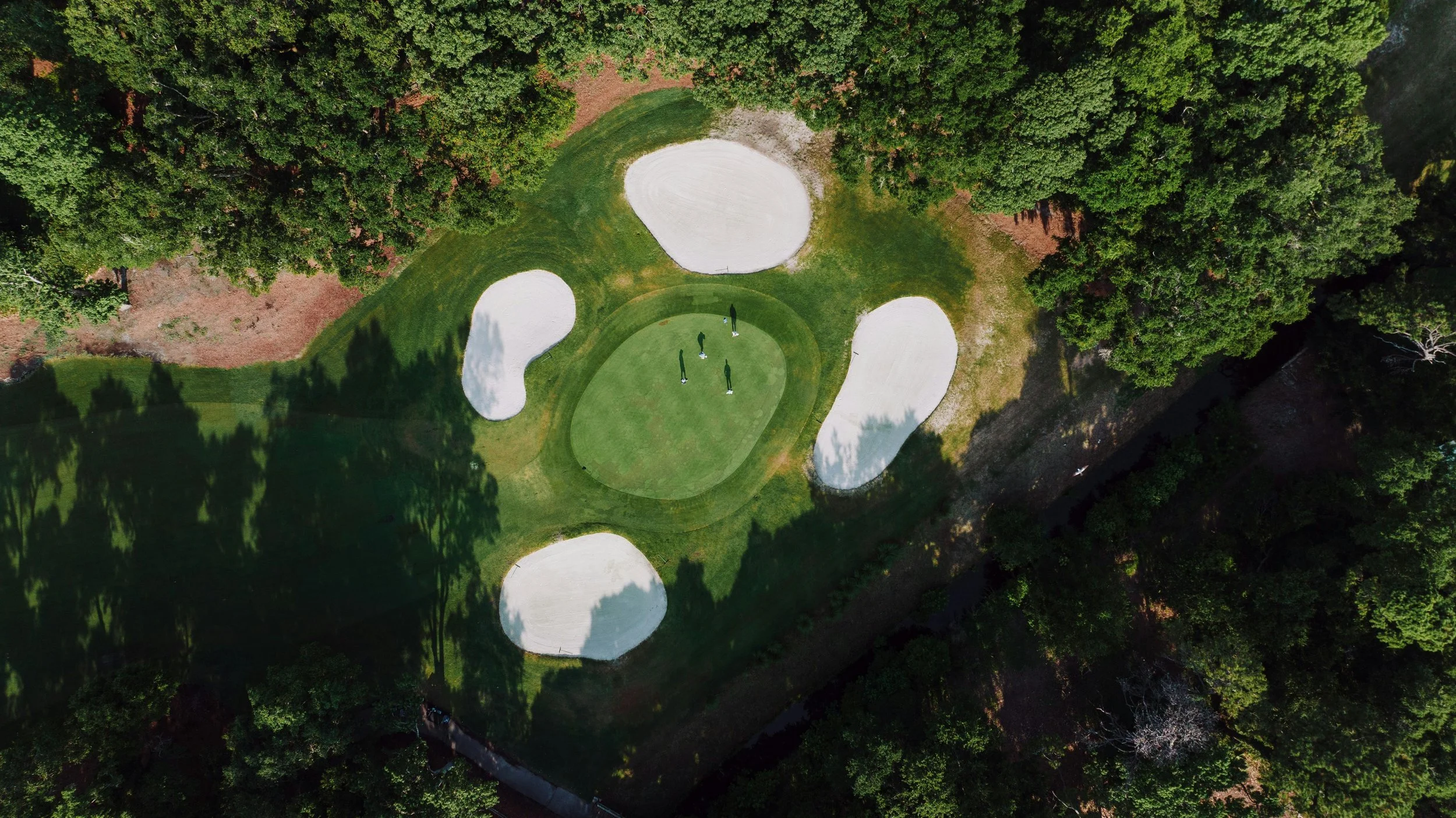
How Golf Courses Are Using Aerial Intelligence to Improve Operations, Reduce Costs, and Elevate Player Experience
From turf stress to irrigation inefficiencies, many golf course issues start before they’re visible from the ground. Aerial insights allow teams to detect problems early, optimize maintenance, and reduce operational costs – without disrupting play.
Golf courses are some of the most visually stunning and operationally complex landscapes to manage.
From turf health and irrigation to drainage, tree coverage, and ongoing maintenance, superintendents and operators are constantly balancing playability, aesthetics, and cost efficiency.
That’s where aerial intelligence is quickly becoming a game changer.
At West Coast Drone Operations, we offer high-resolution aerial imagery, thermal analysis, and geo-referenced deliverables that provide a clearer, faster, and more actionable view of your course.
Why Traditional Course Monitoring Falls Short
Most golf course management still relies on manual inspections and ground-level observations.
While valuable, these methods can miss early-stage turf stress, overlook irrigation inefficiencies, require significant labor time, and delay decision-making.
Aerial data fills these gaps without disrupting play.
Turf Health Monitoring (Before Problems Are Visible)
Subtle changes in turf health often start before they’re visible from the ground.
With aerial imagery, teams can identify stress patterns across fairways and greens, spot irrigation inconsistencies, detect disease or compaction early, and prioritize maintenance zones efficiently.
This allows teams to shift from reactive fixes to proactive course management.
Irrigation and Drainage Optimization
Water is one of the largest operational costs for any course.
Aerial insights make it possible to visualize overwatered and underwatered zones, identify leaks or coverage gaps, detect drainage issues after storms, and support smarter irrigation scheduling.
The result is lower water usage, healthier turf, and reduced utility costs.
Course Mapping and Asset Documentation
Accurate, up-to-date course maps are essential, but often outdated or incomplete.
Aerial capture enables the creation of high-resolution orthomosaic maps, hole-by-hole layouts, tree and asset inventories, and geo-referenced deliverables for planning and reporting.
These assets are valuable for renovation planning, staff coordination, insurance documentation, and stakeholder communication.
Tree Health and Risk Assessment
Tree management is critical for both safety and playability.
Aerial perspectives allow teams to assess canopy density and encroachment, identify dead or hazardous trees, monitor tree health over time, and plan pruning or removal strategically.
This is especially valuable ahead of storms, tournaments, or seasonal maintenance cycles.
Marketing and Membership Growth
Beyond operations, aerial visuals are one of the most powerful tools for attracting players and members.
Golf courses can leverage cinematic flyovers, social media content, website visuals, and event coverage to showcase the beauty and quality of their course.
High-quality visuals don’t just look good — they drive bookings, memberships, and event revenue.
Faster Inspections with Minimal Disruption
Aerial capture allows teams to assess entire courses in a single session with minimal on-site disruption.
Staff can stay focused on operations while gaining a comprehensive view of course conditions, all without interfering with player experience.
Why Golf Courses Partner with West Coast Drone Operations
We’re not just capturing footage, we’re delivering actionable intelligence tailored to your course.
Our approach includes fast turnaround times, clear and usable deliverables, experience working in active environments, and scalable support for single courses or multi-property portfolios.
Aerial imagery can give golf course teams a broader view of turf conditions, irrigation concerns, drainage, landscaping, infrastructure, and changes across the property over time. Tell us what your team is trying to monitor, document, or improve, and we'll help evaluate where aerial capture may be useful.
Discuss Your Course →
Unlocking a Healthier Planet: How Hyperspectral Imaging Helps Us See What Matters
See What Matters: How Hyperspectral Imaging Powers Smarter Sustainability
Hyperspectral imaging unlocks critical environmental insights that traditional tools can’t detect—like early plant stress, water pollution, and subtle land use changes. Learn how this powerful drone-based technology is helping sustainability teams act faster, protect natural resources, and track climate progress from the sky.
At West Coast Drone Operations, we’re always looking for ways to see more — because when you see more, you can do more. That’s especially true when it comes to sustainability. Whether it’s monitoring sensitive habitats, identifying pollution sources, or helping land managers make smarter decisions, one technology is changing the game: hyperspectral imaging.
If you’ve never heard of it before, think of hyperspectral like a superpower for your eyes. Instead of capturing images in just red, green, and blue, hyperspectral sensors collect data from hundreds of wavelengths across the electromagnetic spectrum. That means we can detect subtle changes and patterns invisible to the naked eye — and even to traditional drones.
Why That Matters for the Environment
Sustainability is all about making informed, responsible choices — and hyperspectral gives us the data to do just that. Here’s how:
Spotting Stress Before It Spreads
Plants reflect light differently when they’re healthy versus when they’re stressed from drought, disease, or contamination. Hyperspectral sensors can pick up on those early warning signs before they’re visible. That means farmers, land stewards, and restoration crews can act faster and smarter — saving resources, protecting biodiversity, and reducing long-term damage.
Tracking Water Quality Without Touching the Water
From algae blooms to chemical runoff, hyperspectral data can identify pollutants in water bodies without ever dipping a test strip. This hands-free monitoring is safer, scalable, and far more efficient — especially in hard-to-reach places.
Revealing Land Use Changes in Real Time
Hyperspectral imaging helps distinguish between vegetation types, bare soil, asphalt, or even invasive species. It gives conservation teams and city planners a bird’s-eye view of how land use is shifting and how to respond with sustainability in mind.
Supporting Carbon Tracking and Climate Goals
Governments and businesses alike are being asked to prove their sustainability practices, not just promise them. Hyperspectral imaging plays a role here too — providing precise measurements of biomass, canopy health, and ecosystem services that relate directly to carbon sequestration and climate resilience.
Specialized sensing can reveal information that conventional aerial imagery cannot. Tell us what you're trying to detect, document, or understand, and we'll help evaluate the appropriate aerial approach, platform, and data requirements for the project.
Discuss Your Project →
From the Field: What the Rumored DJI Mavic 4 Changes Could Mean for Drone Operators
DJI hasn’t officially launched the Mavic 4 yet, but leaked details suggest big changes — and a few surprising omissions. As a drone pilot and business owner, I break down the rumored features, what’s missing, the promising new RC Pro 2 remote, and what these updates could mean for your fleet and future projects.
At West Coast Drone Operations, we’re always keeping an eye on gear that could make a real difference for our clients. Thanks to the team over at DroneXL, we’re getting a clearer picture of what to expect from DJI’s upcoming Mavic 4 — and what’s missing.
Here’s what stands out from a working pilot’s perspective.
Some Big Features Didn't Make the Cut
According to DroneXL’s reporting, several highly anticipated features won't be part of the Mavic 4 lineup:
No Cine version with ProRes support — a big consideration if you’re shooting broadcast or cinematic footage.
Camera sensors remain the same as the Mavic 3 — still very capable, but not the sensor upgrade many of us hoped for.
RC Track mode won’t be included, although a form of tracking will still be available via the new remote.
Electronic ND filters won’t ship at launch.
For commercial operators, it’s important to know these limitations upfront when planning gear investments.
RC Pro 2: A Real Step Forward
On a more exciting note, the new DJI RC Pro 2 looks like it could be a game-changer in the field:
A bright, foldable 7" mini-LED screen that auto-rotates for vertical shooting — a huge plus for clients who want content optimized for social media.
Joysticks that automatically rise and retract, speeding up setup and teardown.
A more rugged, portable design that could make a real difference during tight shoots or fast-moving jobs.
If the RC Pro 2 delivers as promised, it could improve workflows for both creative and technical missions.
Pricing and Launch Notes
Based on DroneXL’s coverage, European pricing will land around:
€2189 for the Pro Combo
€2899 for the Fly More Combo
€3849 for the Creator Combo (with RC Pro 2 and extra gear)
U.S. pricing hasn't been announced yet, but with retail boxes already spotted, an official launch is close.
Big thanks to DroneXL for pulling together these early details.
We’ll be watching closely to see how the Mavic 4 fits into real-world commercial operations — and whether it’s worth adding to the fleet.
Different projects call for different aircraft, capture methods, and deliverables. West Coast Drone Operations builds each operation around what the client actually needs to see, document, or communicate — not around a single drone platform.
Discuss Your Project →
The Role of Drone Technology in Advancing Sustainability
Drones are rapidly becoming a game-changer in sustainability efforts worldwide. By reducing carbon emissions, enhancing wildlife conservation, and optimizing renewable energy infrastructure, drones provide cost-effective and eco-friendly solutions across industries. Whether assisting in precision agriculture, disaster response, or urban planning, these aerial tools enable smarter, data-driven decision-making for a greener future. At West Coast Drone Operations, we are committed to harnessing drone technology to support sustainability initiatives and drive environmental innovation.
As the world moves toward more sustainable practices, technology is playing an increasingly vital role in environmental conservation and resource management. Drones, in particular, have emerged as powerful tools for advancing sustainability efforts across industries. From monitoring ecosystems to reducing carbon footprints in industrial operations, drone technology is revolutionizing the way we protect and manage our planet’s resources.
How Drones Contribute to Sustainability
Drones offer a range of benefits that make sustainability initiatives more efficient, cost-effective, and data-driven. Here’s how drone technology is being used to support environmental and sustainability goals:
1. Reducing Carbon Emissions with Aerial Data Collection
Traditional data collection methods in industries such as agriculture, infrastructure, and environmental monitoring often rely on heavy machinery, helicopters, and ground vehicles—all of which contribute to carbon emissions. Drones provide an eco-friendly alternative by enabling precise, high-resolution aerial surveys without the fuel consumption and emissions associated with traditional methods.
2. Enhancing Conservation and Wildlife Protection
Drones are transforming wildlife conservation efforts by allowing researchers to monitor endangered species, track migration patterns, and detect illegal activities such as poaching and deforestation. With advanced thermal imaging and AI-powered recognition, drones can survey large and remote areas with minimal human disturbance, providing critical data for conservationists.
3. Optimizing Agricultural Sustainability
Agriculture is a major contributor to greenhouse gas emissions, but drones are helping to mitigate this impact through precision farming techniques. By using multispectral imaging and real-time data analytics, drones enable farmers to optimize irrigation, detect crop diseases early, and reduce the need for chemical fertilizers and pesticides. This leads to more sustainable farming practices and improved crop yields with minimal environmental impact.
4. Supporting Renewable Energy Development
The shift toward renewable energy sources like solar and wind power requires continuous monitoring and maintenance of infrastructure. Drones are being used to inspect solar farms and wind turbines more efficiently, identifying defects, optimizing energy production, and reducing the need for manual inspections that require extensive transportation and human resources.
5. Disaster Response and Environmental Protection
From wildfires to oil spills, drones are increasingly being deployed in disaster response scenarios to assess damage, track environmental hazards, and support recovery efforts. Their ability to capture real-time aerial data helps emergency responders and environmental agencies make informed decisions quickly while minimizing risk to human personnel.
6. Smart Urban Planning and Green Infrastructure
Sustainable cities rely on innovative solutions to manage traffic, monitor air quality, and design green infrastructure. Drones provide urban planners with the ability to map out city layouts, assess environmental impact, and even monitor the effectiveness of green roofs, urban forests, and permeable pavements that reduce water runoff and heat island effects.
The Future of Drones in Sustainability
As drone technology continues to evolve, the integration of AI, automation, and advanced sensors will further enhance its capabilities in sustainability applications. Future developments may include:
Autonomous environmental monitoring for real-time tracking of deforestation, ocean pollution, and climate change effects.
Carbon tracking drones that measure and analyze emissions from industrial sites, helping businesses comply with sustainability regulations.
Reforestation drones that plant trees in degraded areas, accelerating global reforestation efforts.
Final Thoughts
Drones are not just tools for convenience or entertainment, they are shaping the future of sustainability. By enabling more efficient data collection, reducing emissions, and supporting conservation and disaster response efforts, drones are becoming a cornerstone of environmental innovation.
From environmental documentation to infrastructure and site monitoring, aerial data can give teams a clearer view of changing conditions while reducing the need for some ground-based access. Tell us what you're trying to understand, document, or monitor, and we'll help evaluate where aerial capture may fit.
Discuss Your Project →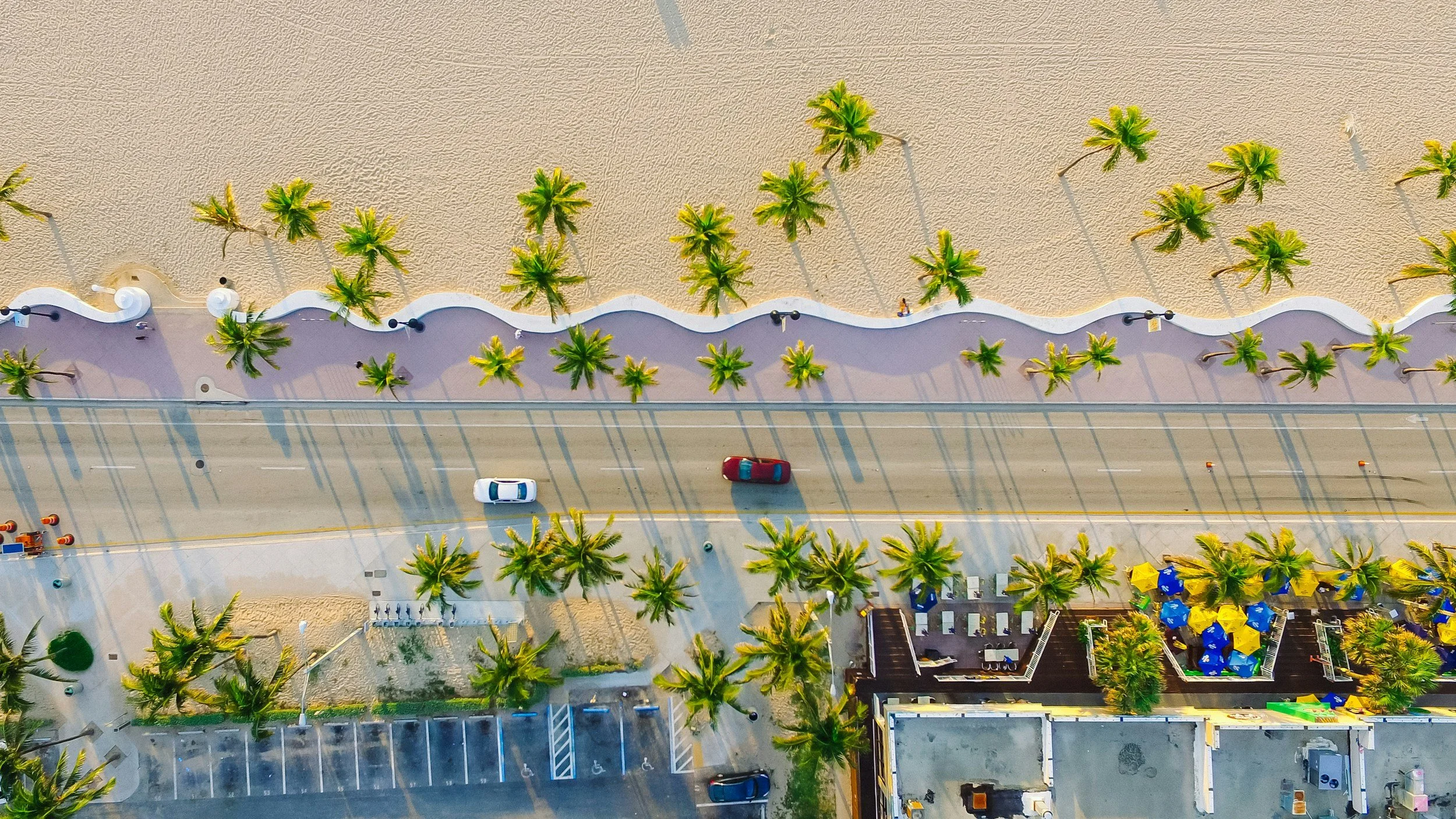
Why Every TV Production Needs Drone Cinematography
Drone cinematography has become a standard part of modern TV production. Explore how aerial footage supports storytelling, production value and efficiency, and what to consider when choosing a drone operator.
In today’s fast-paced and visually driven entertainment industry, TV production companies are constantly seeking innovative ways to captivate audiences. One of the most transformative tools in modern cinematography is the drone. From stunning aerial views to dynamic action shots, drone cinematography for film and television has revolutionized how productions capture scale, movement and perspective.
1. Elevated Production Value
Aerial shots were once exclusive to big-budget productions that could afford helicopters and cranes. Now, drones provide cinematic, high-quality aerial footage at a fraction of the cost. Whether capturing expansive landscapes, tracking vehicles in motion, or creating dramatic establishing shots, drone footage instantly elevates a TV show's production value.
2. Cost-Effective Filmmaking
Traditional aerial cinematography requires helicopters, pilot fees, permits, and extensive planning. In contrast, drones significantly reduce expenses while offering greater flexibility in shot selection. Productions can achieve breathtaking visuals without exceeding their budget, making drone cinematography a cost-effective investment.
3. Unique Angles and Dynamic Movement
Drones allow cinematographers to achieve previously impossible shots, from seamless fly-throughs to low-altitude tracking shots that follow actors through action sequences. With their compact size and maneuverability, drones can navigate tight spaces, hover inches above water, or smoothly ascend from ground level to sky-high perspectives—all in a single take.
4. Faster Setup and Greater Efficiency
Time is money in TV production, and drones streamline the filmmaking process. Unlike cranes and dollies, which require extensive setup, drones can be launched within minutes, capturing multiple angles quickly and efficiently. This reduces downtime and increases on-set productivity, allowing directors to focus on storytelling rather than logistics.
5. Safe and Accessible Filming in Challenging Locations
Drones enable filmmakers to capture stunning visuals in locations that may be dangerous or inaccessible for traditional filming methods. From rugged mountain terrains to fast-paced urban environments, drones provide unparalleled access to unique perspectives while minimizing risks to crew members.
6. Enhancing Storytelling with Immersive Shots
Great cinematography isn’t just about aesthetics—it’s about storytelling. Drones enhance visual narratives by creating a sense of scale, tension, and emotion. Whether depicting a character’s isolation with a vast aerial pullback or intensifying an action sequence with a high-speed chase, drones bring storytelling to life in ways that ground-based cameras cannot.
7. Compliance with Industry Standards
With the rise of drone usage in film and television, industry regulations have evolved to ensure safe and legal operations. Professional drone operators are licensed and experienced in FAA regulations, ensuring compliance while delivering stunning visuals that meet broadcast standards.
From television and documentary work to branded and commercial productions, West Coast Drone Operations provides experienced aerial crews and production-ready imagery built around the needs of your shoot.
Discuss Your Production →Work with a Professional Drone Operator
At West Coast Drone Operations, we bring years of television and production experience to aerial cinematography for TV, news and film. Our team provides cinematic aerial capture, professional drone operations and production support designed to integrate seamlessly into the needs of each shoot. Explore our Film + TV production services or contact us to discuss your next production.